

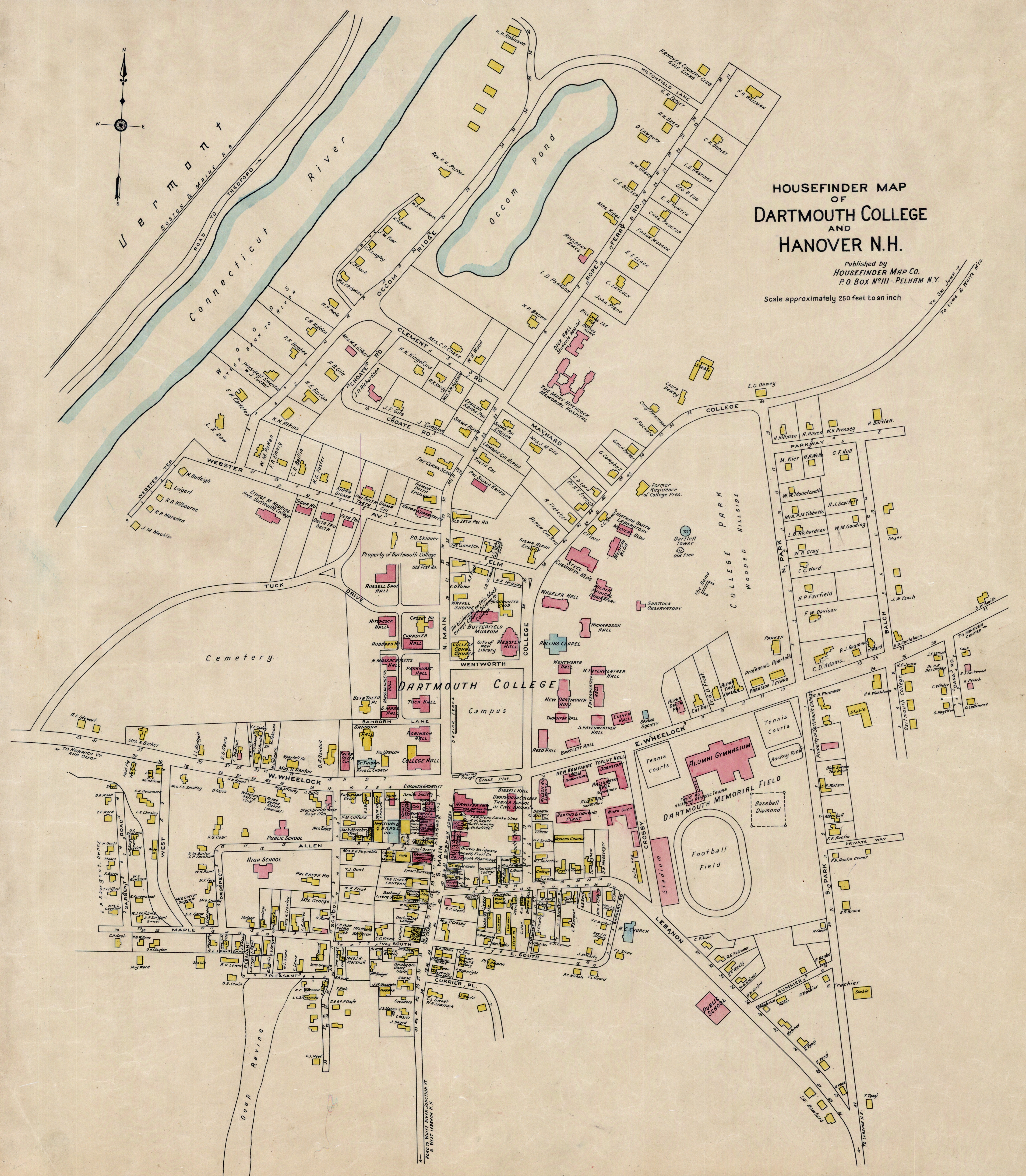
Jigsaw: 1928 Map of Hanover
While editing an old post with a 1950s view from Baker Tower, I noticed my link to this 1928 map of Hanover. It deserves a closer look.
Zooming in rewards you with details: the original Nugget Theater, names of local businesses, two brick schools on Allen Street, homeowners, and plenty more to explore.
Sanborn Map Collection at the Library of Congress.
How-to guide for using the maps to find the history of your house.
The map at full resolution
Here it is at last at its real size. The scan is 6,447 pixels across, enough to read the name lettered on your own house. It is free to download, along with every Hanover and Lebanon fire insurance map I have gathered, at the new archive:
https://puzzles.curioustorian.com/archive/
The map is "Housefinder map of Hanover, 1928", made by the House Finder Map Company of Pelham, New York. The copy scanned here is held by Rauner Special Collections Library at Dartmouth College, G3744.H3 1928 .H68 c.2.
Thanks for reading…
Cameron Cross
Yes, I am curious about the so schools on Allan Street. How big they were etc. How interesting!