
West Lebanon and White River Junction, Part 2
Didn't want to have you do last week's puzzle again!

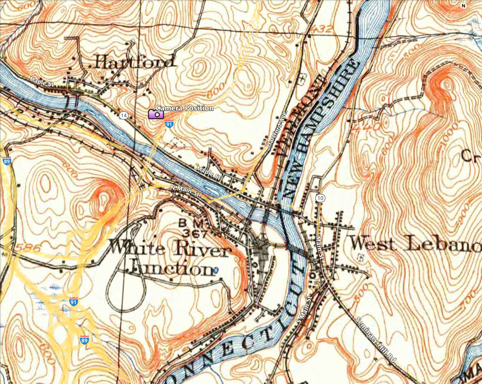
Puzzle for December 7, 2025: 1909 Survey Map
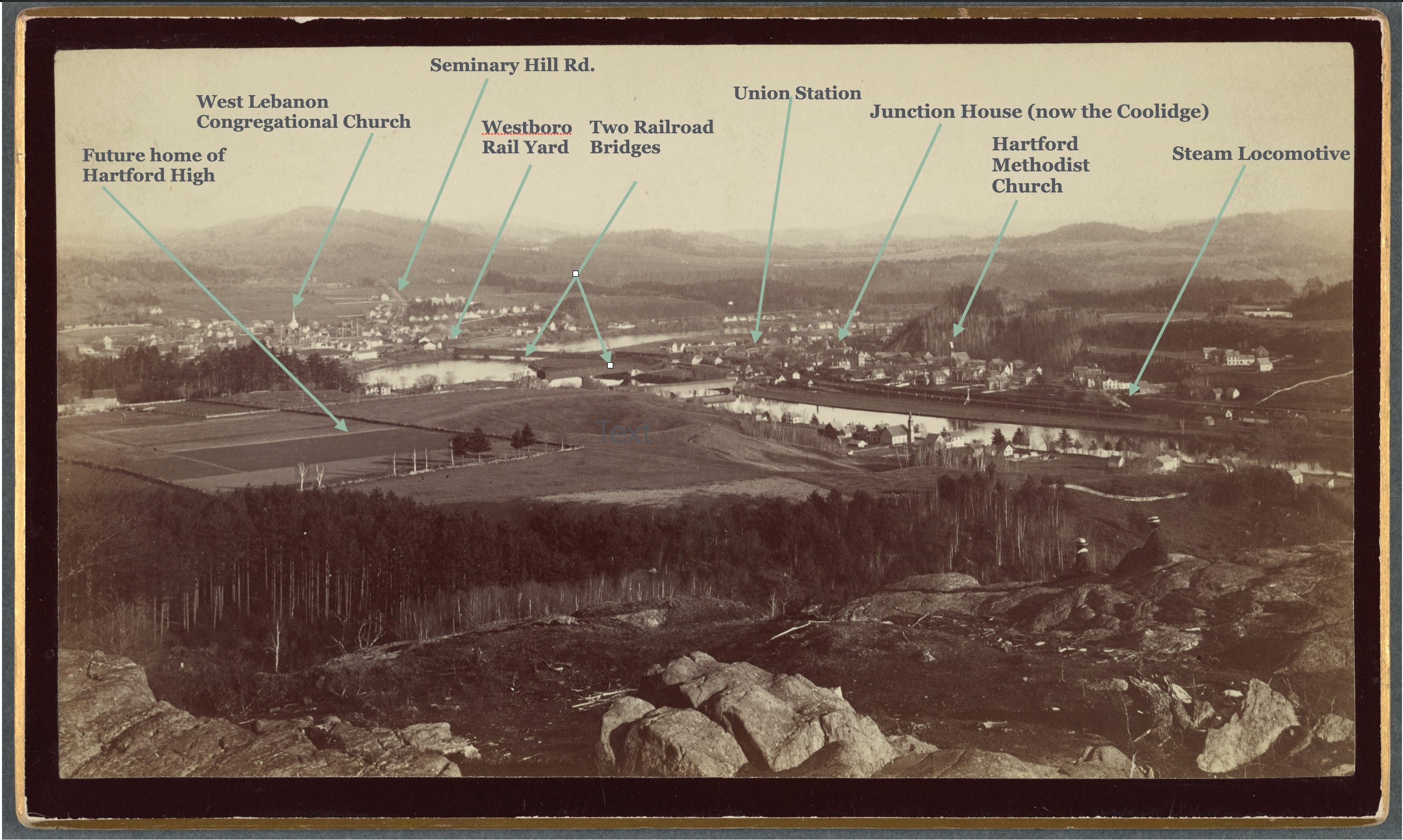
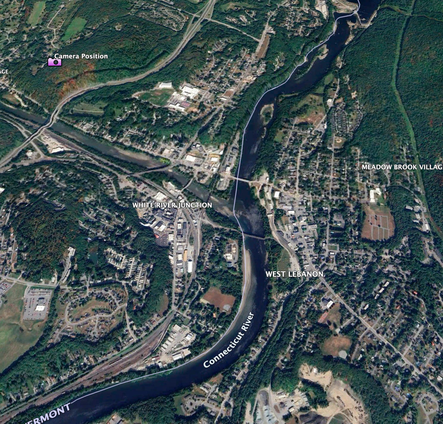
When I first looked at last week’s picture, I couldn't immediately grasp which river was which and what direction you were looking at, but I finally figured it out and we've got the Connecticut River flowing north to south from left to right between West Lebanon and whatever White River Junction. And then we have the White River flowing from west to east, right to left to join the Connecticut.
Click here for hi-res version for close examination.
The two folks sitting on the rocks are overlooking a steep gully. In 2025, if the hill was cleared, and you crept forward to where you could see the bottom, you’d see cars heading north across the I91 bridge. After the bridge the road takes a big bend to the east and then back to the north, thus avoiding doing even more blasting to the left and having to relocate the Hartford Point Cemetery to the right. The highway would have been straighter there but for the cemetery.
I looked at the 1906 map and I didn't see a road or trail to the top, so I wonder how the two people and the photographer and all his equipment conquered that steep slope.
Junction House:
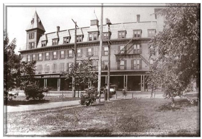
Looks pretty nice with a park there…
If you like these posts, consider joining the mailing list.
Thanks for reading,
Cameron Cross
The Curioustorian
Sources and links of interest, in no particular order:
.The Junction House
Union Station
In-depth look at Hartford's Historic District
Search the Rauner Library Digital Photo Archive
I suspect they may have hiked over from one of the houses on Christian St. that was about the same elevation, just a guess! Great post!
....and the White River airport came and went between all these map/photo editions......