
A companion to Four Housepower. The post carries one map, the before and the after, because one is all a post can carry without turning into an atlas. This is the rest of it, at a size worth zooming into.
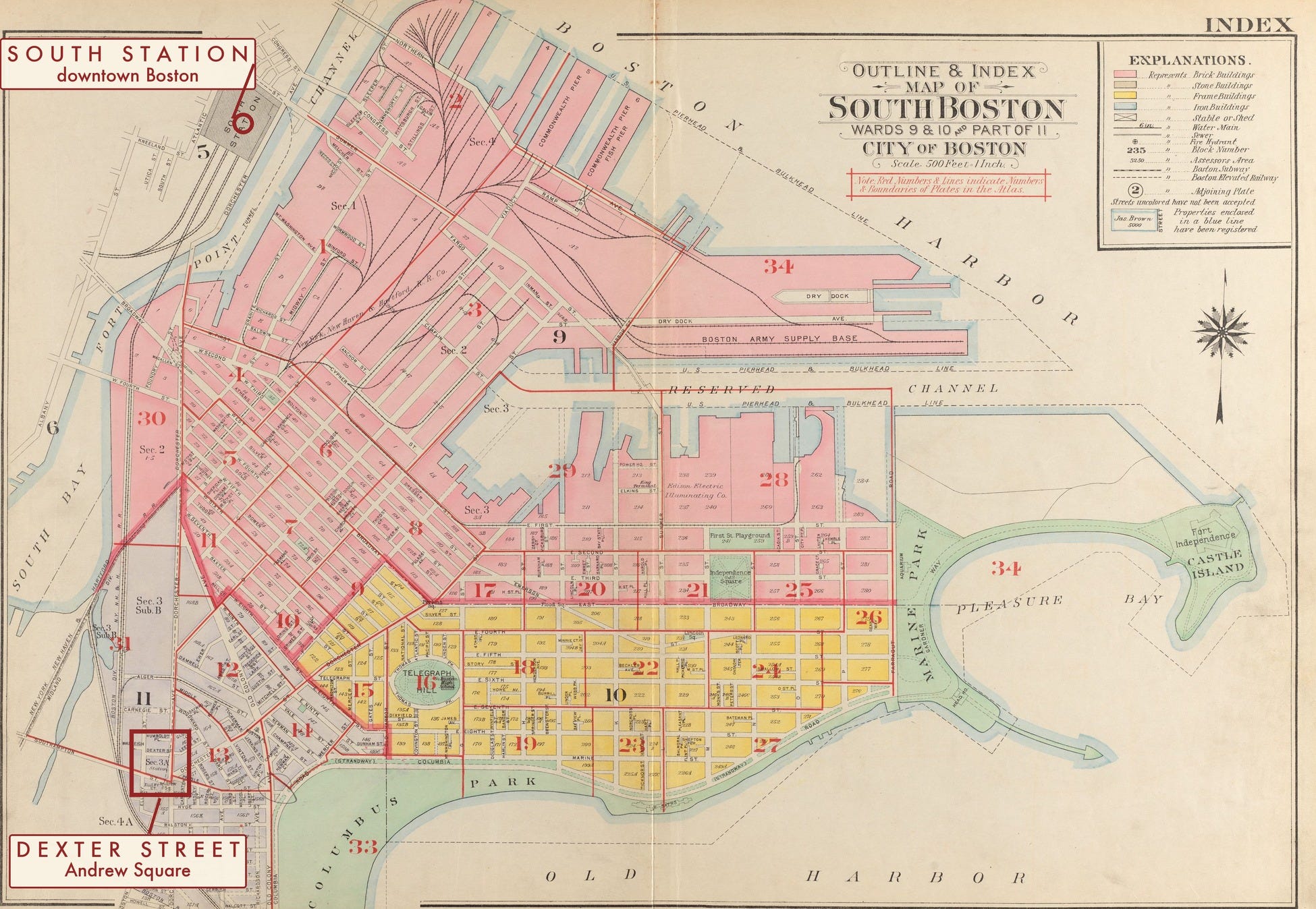
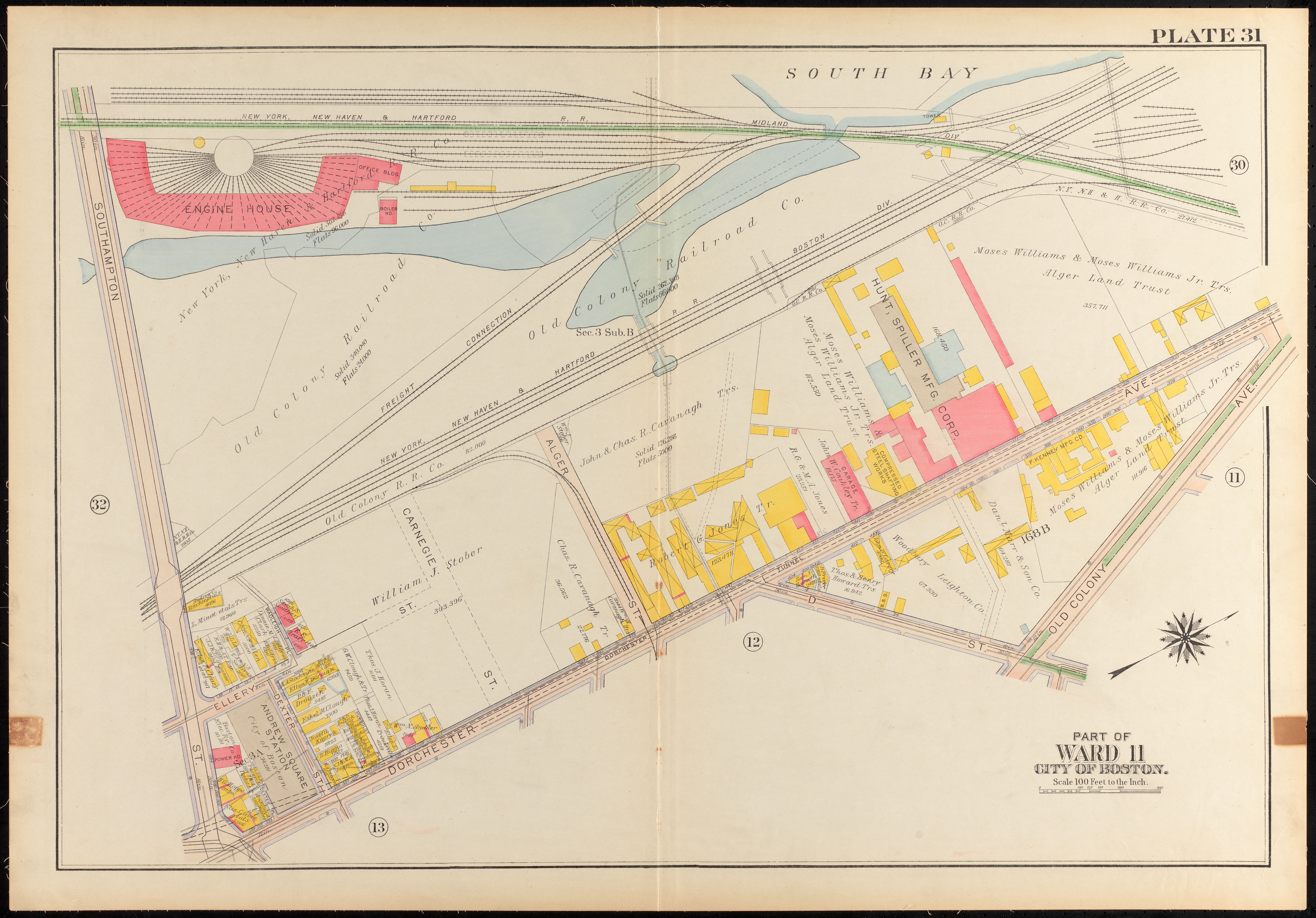
The source is the G. W. Bromley atlas of the City of Boston, the fire-insurance style property atlas that shows every building footprint, what it was built of, and who owned the lot. South Boston is plate 31. Two editions matter here: 1910, the neighborhood before the Dorchester tunnel, and 1919, the neighborhood after Andrew Square Station had eaten a block of it.
One thing to know before you look at any of them. Plate 31 is not printed north up. It is turned roughly sixty-three degrees, with north toward the upper right corner. Dexter Street runs very nearly due east and west on the ground, which is why it sits as a diagonal on the sheet. Get that wrong and nothing lines up.
Where to look first
1910, before
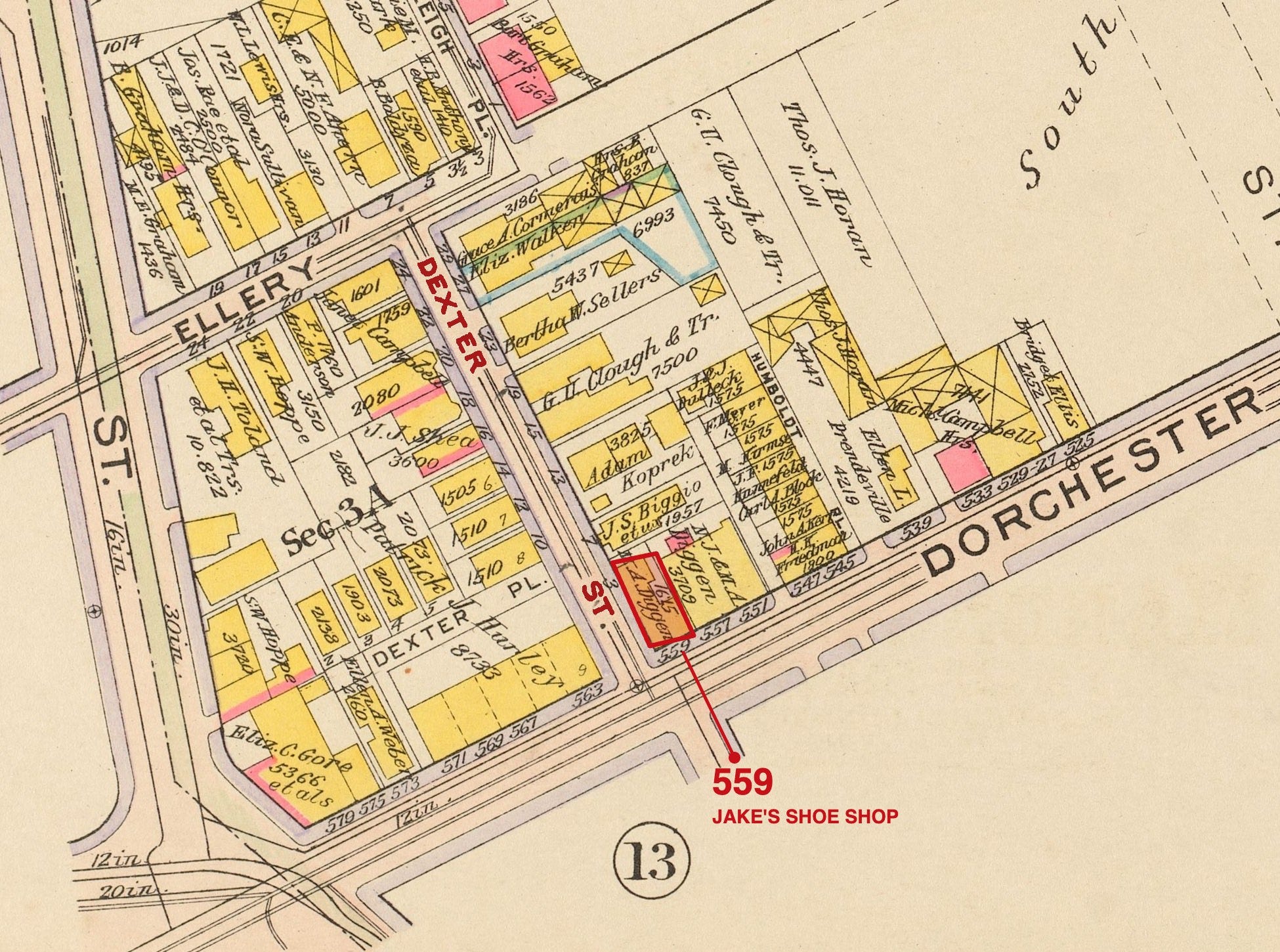
The lettering is the sheet’s own engraving, recolored so you can find it. Nothing has been pasted on top.
1919, after
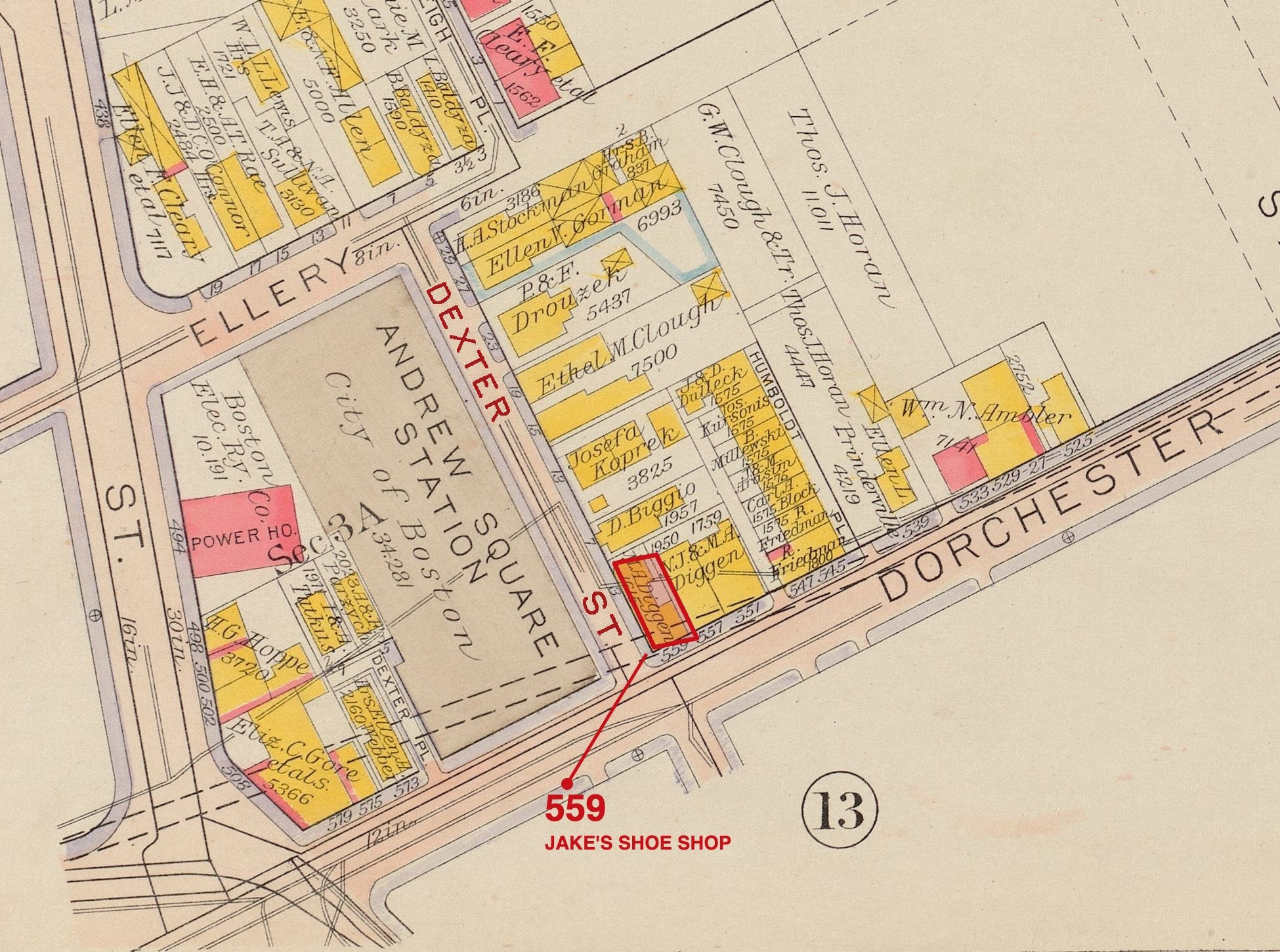
The houses that stood on it are simply gone from the sheet.
The trench in the photograph is the Dorchester Tunnel, which is the Red Line now. Andrew station stands at the end of Dexter Street today, and it opened in June 1918, two years after the picture was taken.
Full resolution
Both complete plates, as scanned. They are large files and they reward it: the footprints carry owner names, and you can follow a single lot line across nine years.
Bromley plate 31, South Boston, 1910. 7,913 pixels wide, 5.8 MB
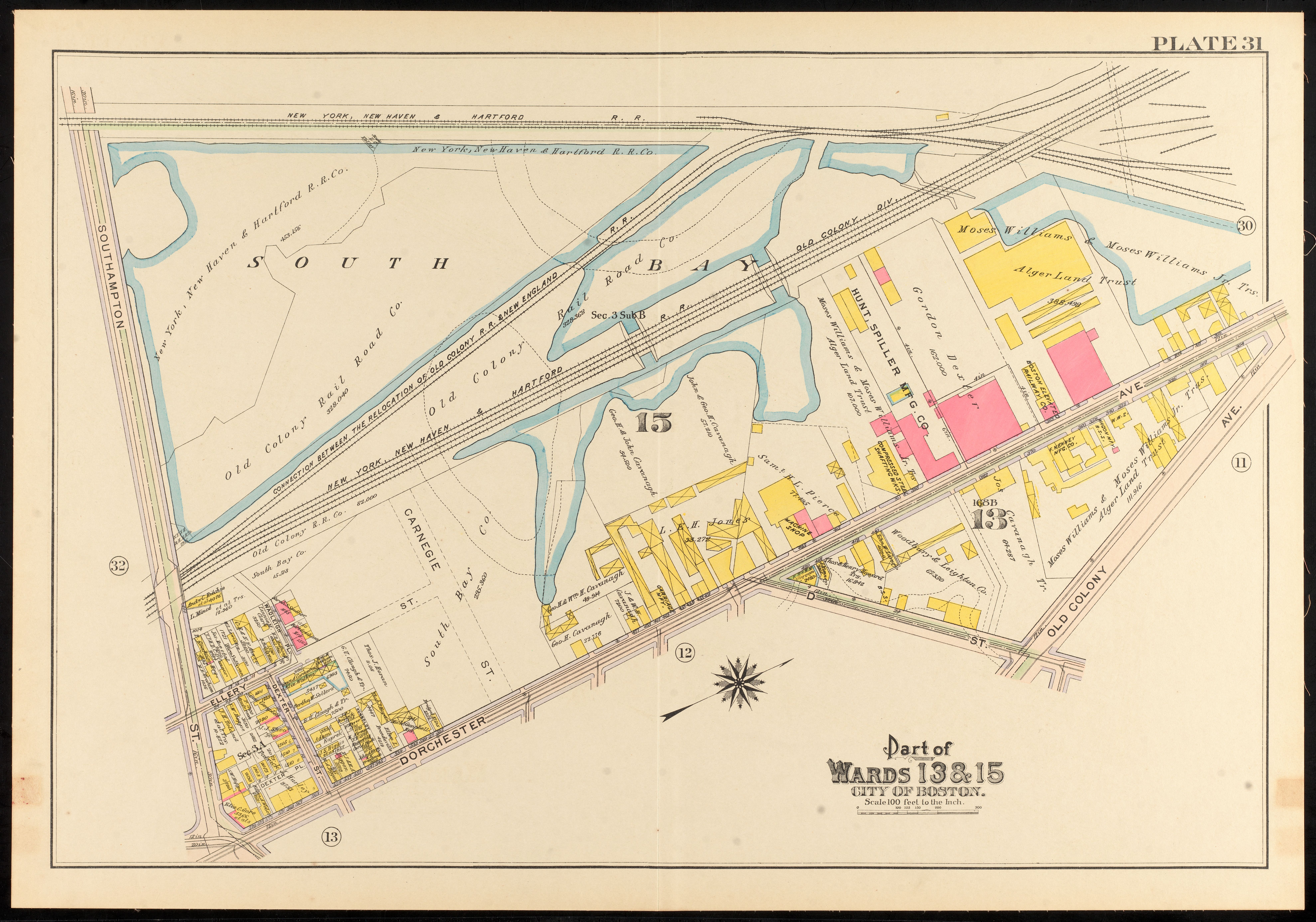
Bromley plate 31, South Boston, 1919. 7,926 pixels wide, 5.7 MB
Thanks for your support, as always,
Cameron Cross
Sources
G. W. Bromley & Co., Atlas of the City of Boston, plate 31, 1910 and 1919 editions, and the outline and index sheet from the 1919 edition. Digitized by the Norman B. Leventhal Map & Education Center at the Boston Public Library, which places them under no known copyright restrictions.
The 1919 plate at the Leventhal Center