

Jigsaw for November 21, 2026: the covered bridge at Pompanoosuc
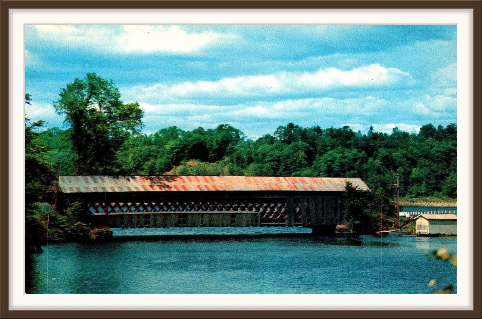
Pompanoosuc sits where the Ompompanoosuc River meets the Connecticut, in the northeast corner of Norwich. The 1905 history of Norwich says the river’s name means “the place of very white stones”; others state that the Abenaki name meant “Fishing Place.”
Abenaki families farmed here. In the Hartford Historical Society newsletter in 2011, Martha Knapp named Pompanoosuc as one of the nearest recorded Abenaki farming places. They planted corn, beans and squash in hills along the rivers, and fertilized each hill with the herring and shad that ran up in the spring.
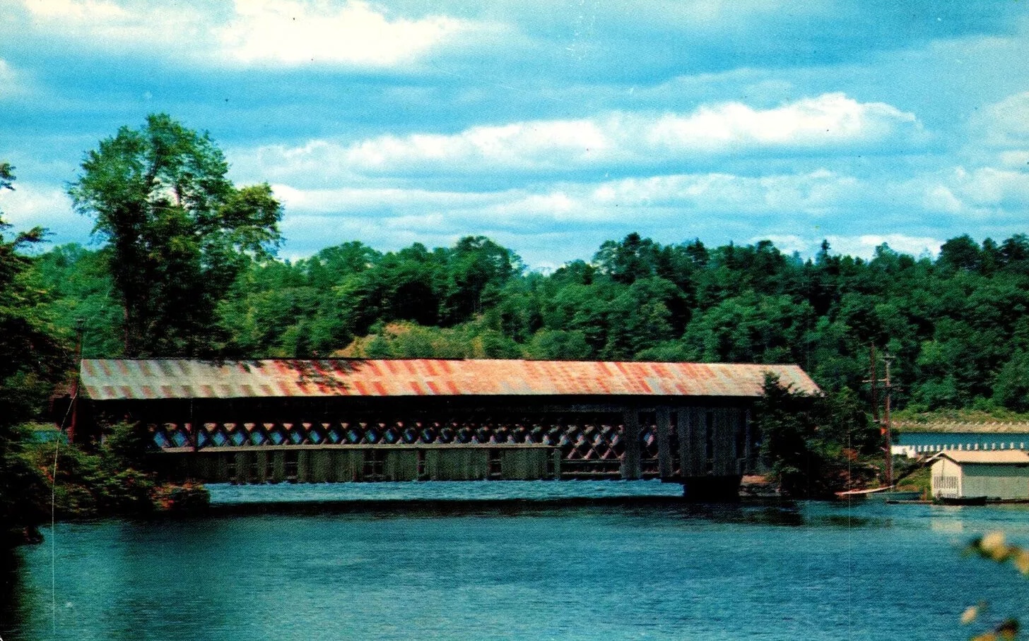
The road north through the village crossed the Ompompanoosuc on a covered bridge, one wooden span of 120 feet. When the federal highways were numbered in 1926, that road became U.S. Route 5, and all of its traffic went through the bridge.
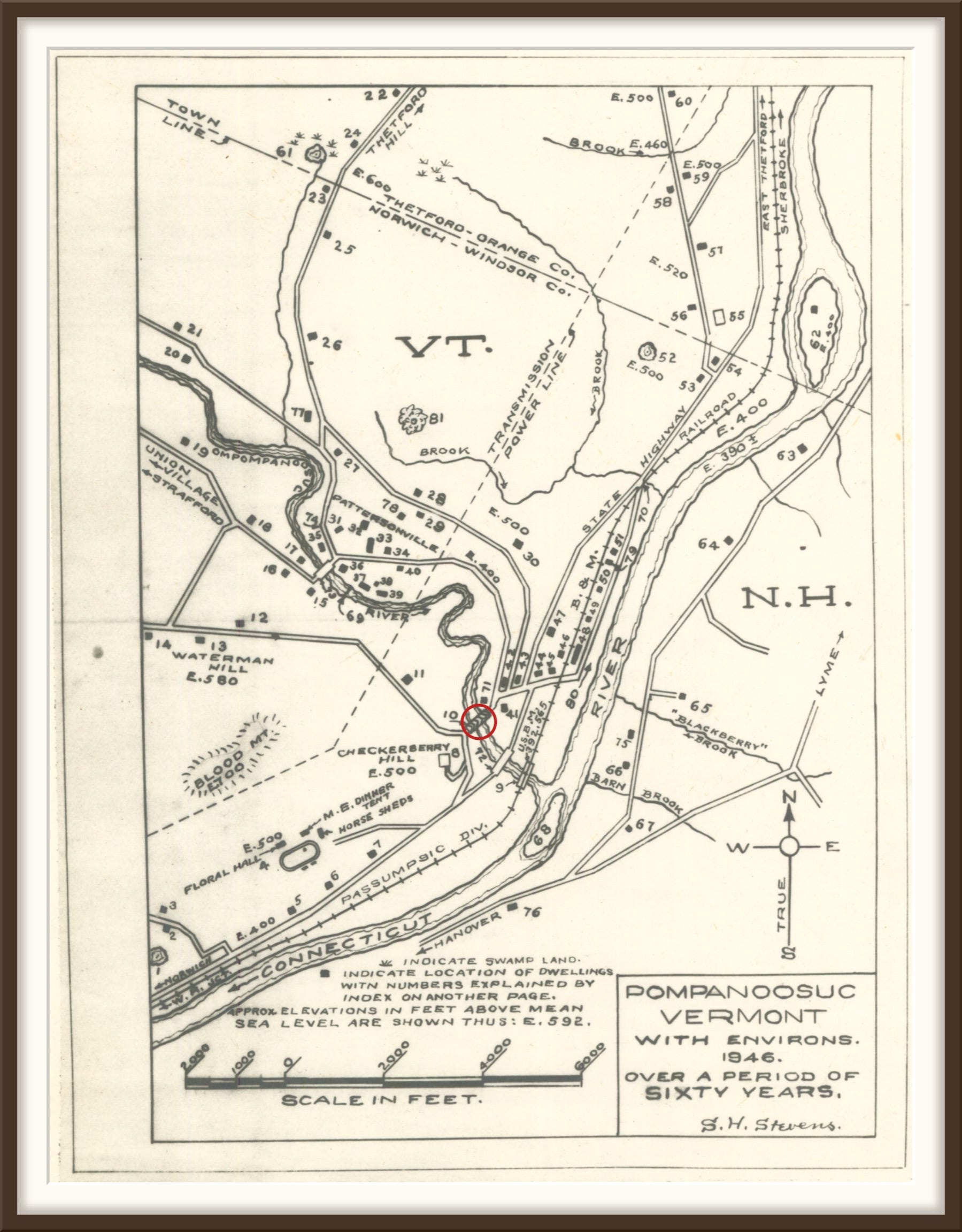
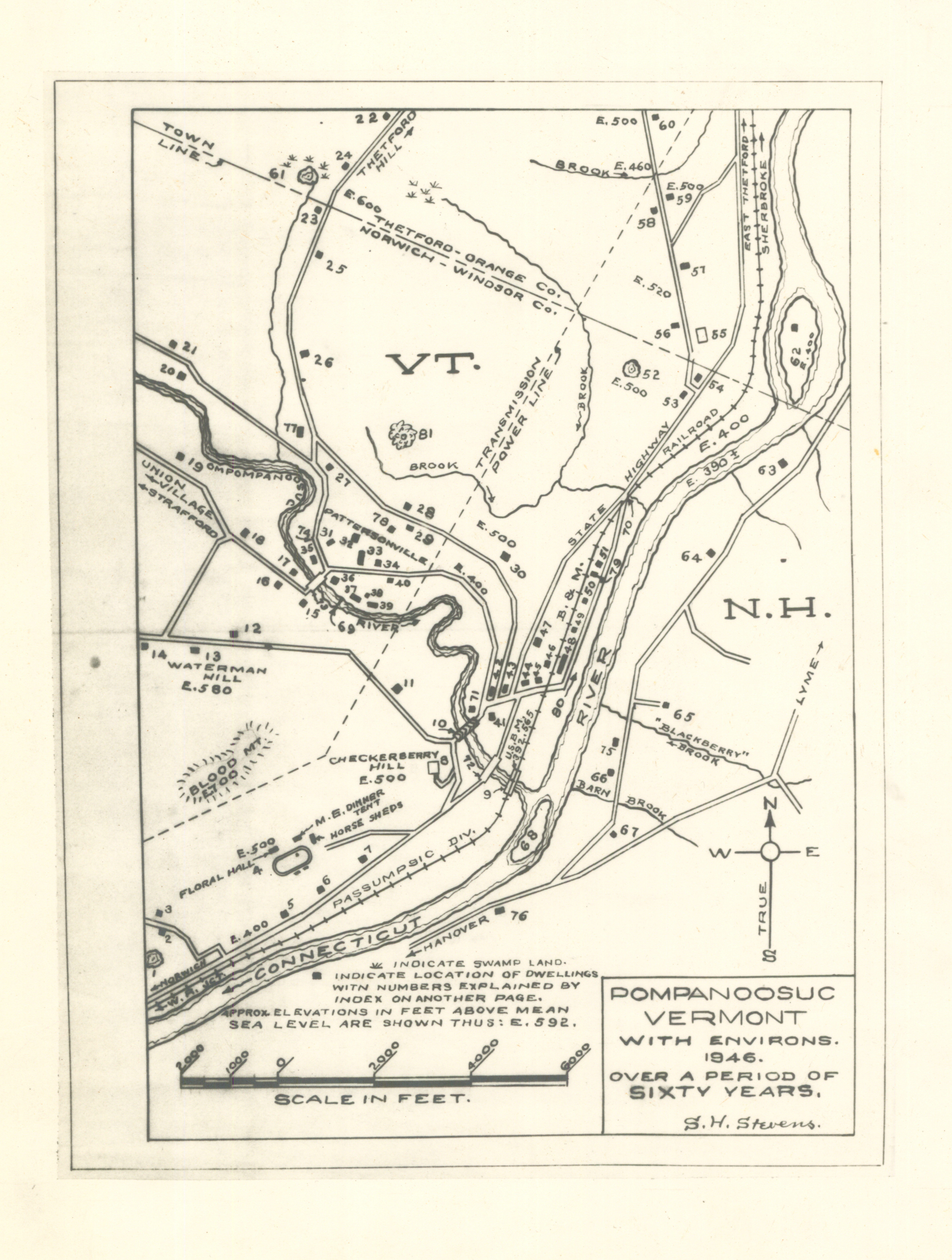
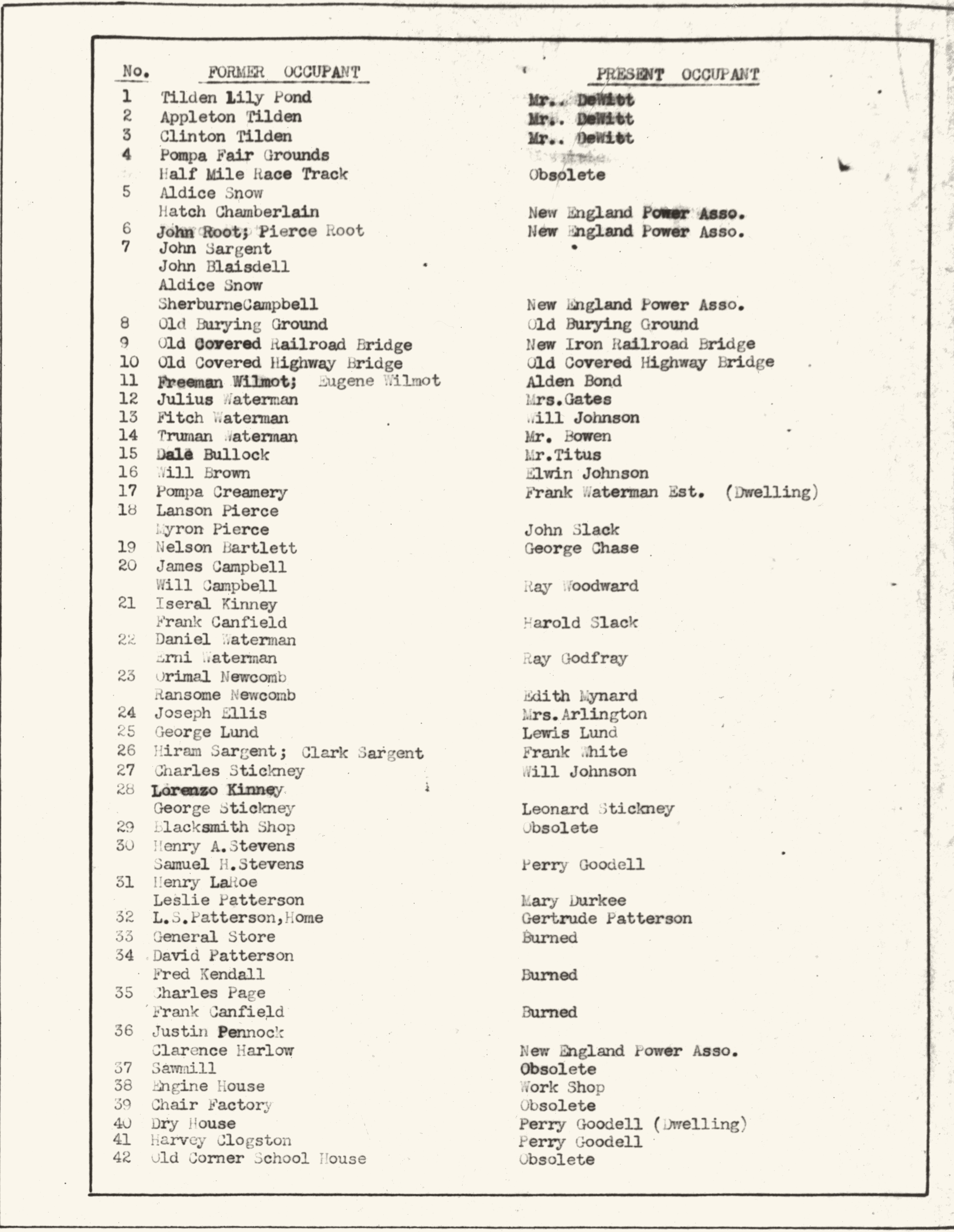
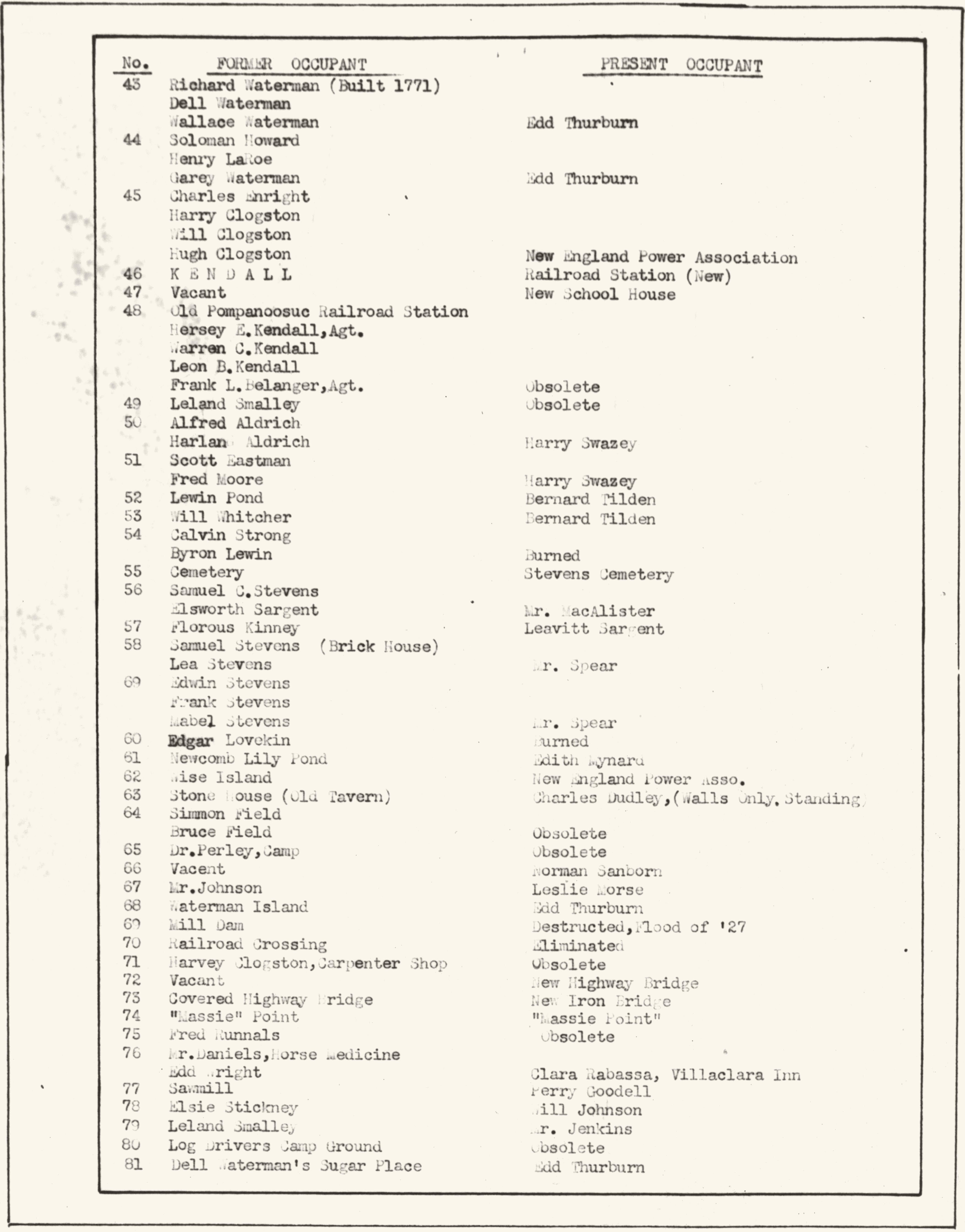
In 1946 S.H. Stevens drew a map of Pompanoosuc “over a period of sixty years.” He numbered 81 places on it and typed an index of who had lived or worked at each one, then and now.
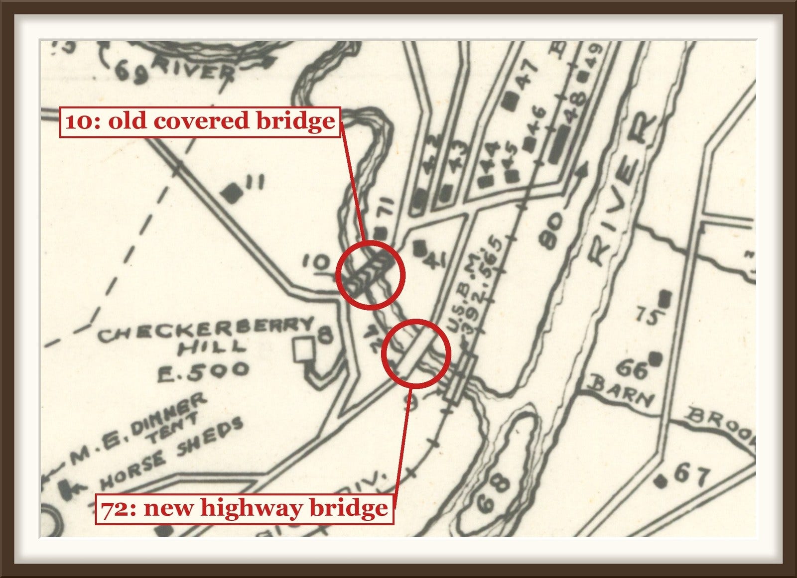
Number 10 reads “Old Covered Highway Bridge” in both columns. It was still standing. Number 72, right beside it, had been “Vacant.” In 1946 it was “New Highway Bridge.”
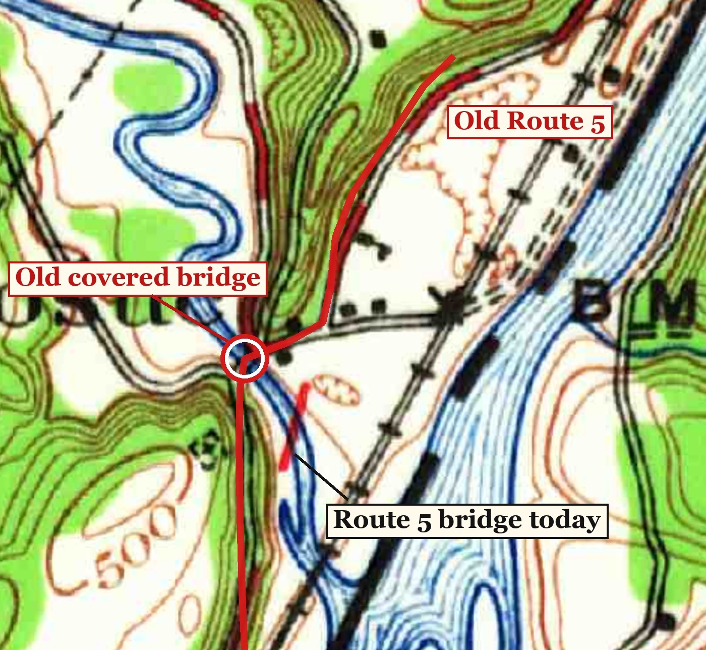
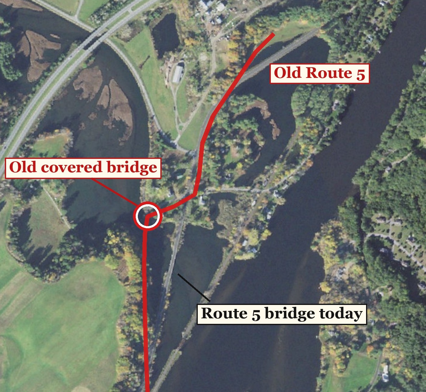
The covered bridge stood a short way upstream from today’s Route 5 bridge. The 1931 Geological Survey map, lined up with a recent aerial photograph, shows where the old road crossed. Note how much higher the water stands today: the narrow river of 1931 is now a wide pool.
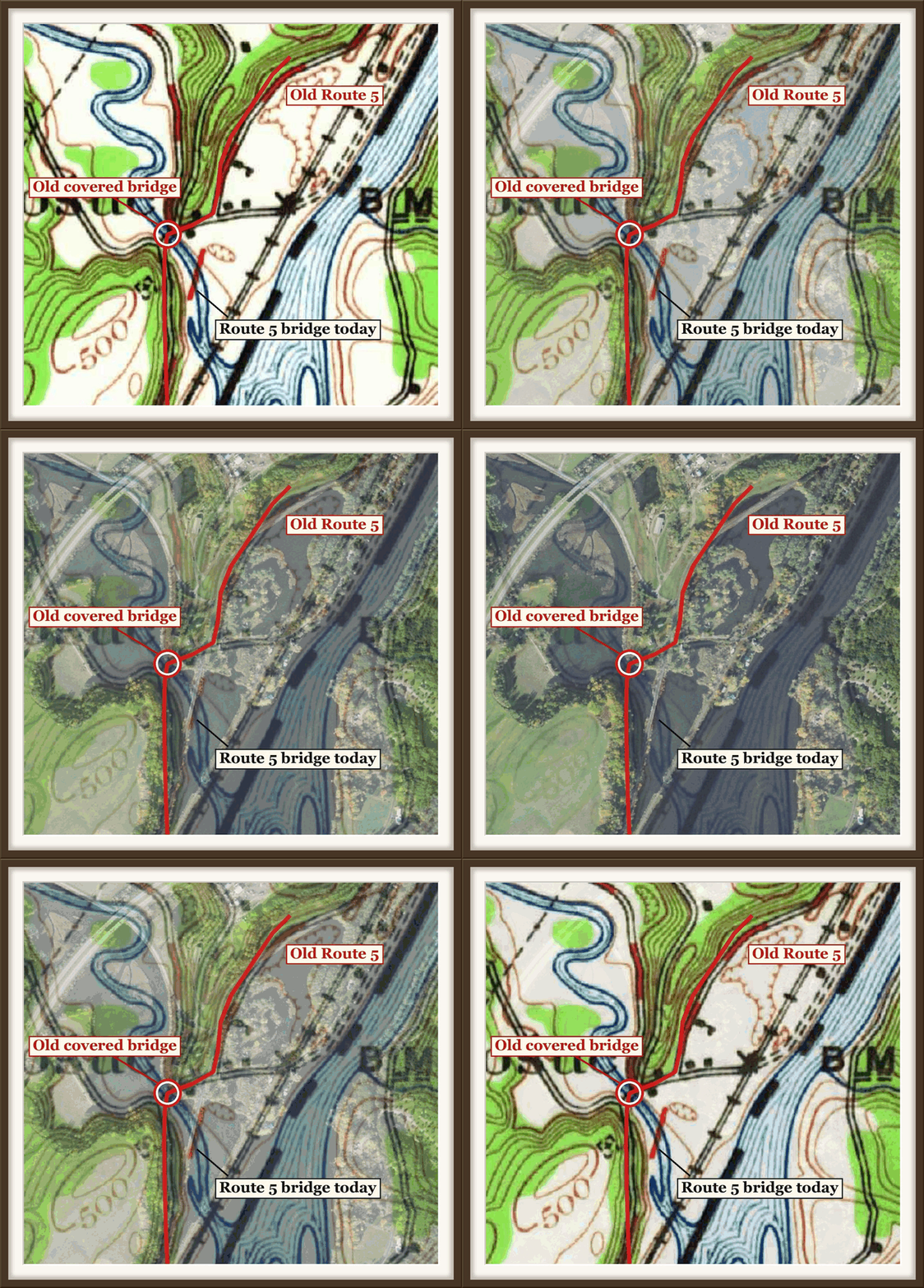
Fade between them yourself, with a button.
The Wilder Dam, which went into service in December 1950, backed the Connecticut up past Pompanoosuc and flooded the old crossing. Where the covered bridge stood is now a boat launch, and you can still see the old pier.
Other entries on the river: number 9, the old covered railroad bridge, had become a new iron railroad bridge. Number 73, a covered highway bridge upstream at Pattersonville, had become a new iron bridge. Number 69, the mill dam, reads “Destructed, Flood of ’27.”
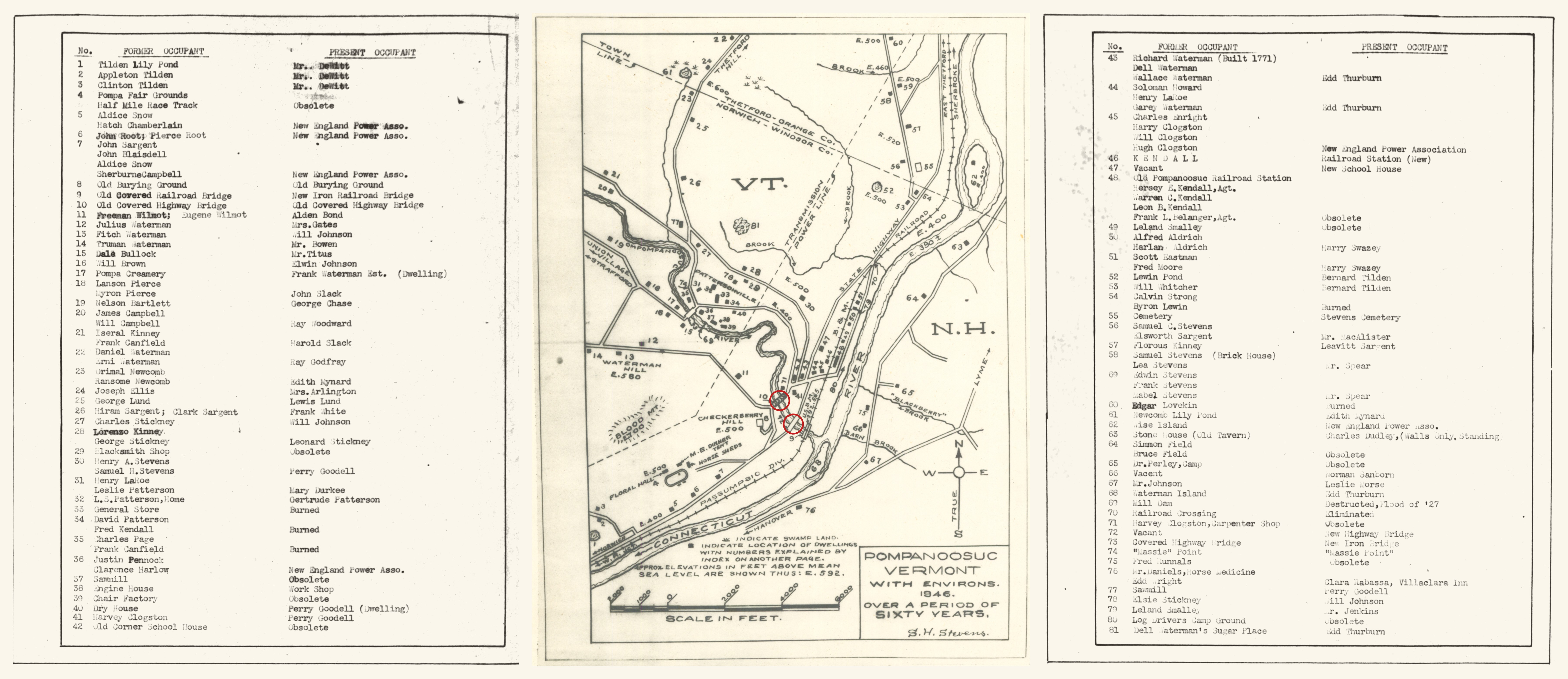
All 81 entries are typed out here: the Stevens index, transcribed.
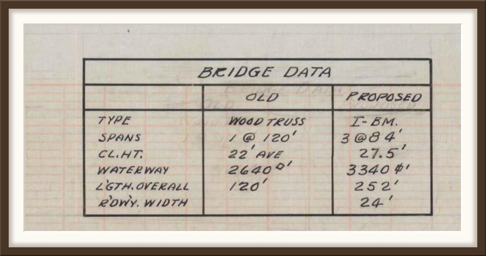
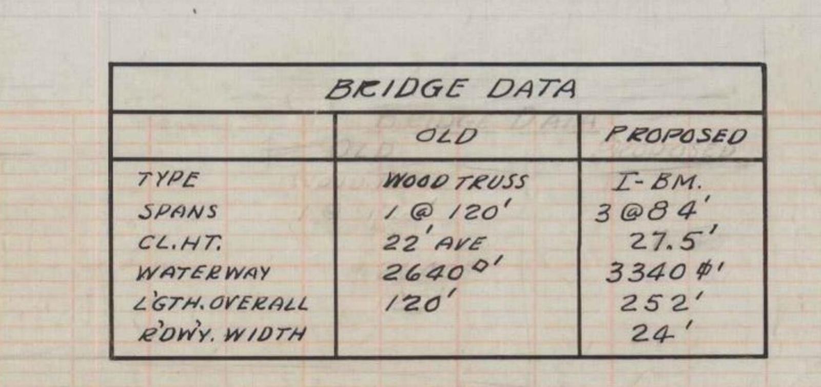
The new bridge came from a 1937 state highway plan. The old bridge was one wooden span of 120 feet. The new one was steel, three spans of 84 feet, 252 feet in all, with a 24-foot roadway. Route 5 moved onto it, and the covered bridge was left on a side road.
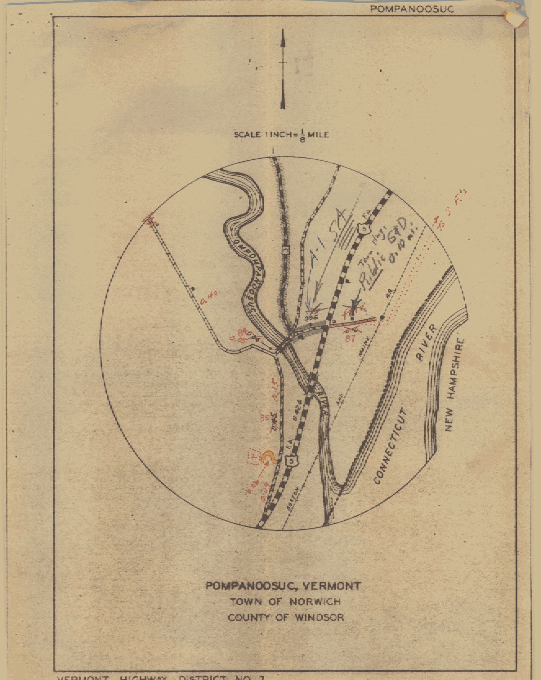
The highway department’s 1945 map of the village shows Route 5 on its new line, and a second road heading north up the river toward Union Village. That road carries a small box with a 3 in it. Today it is Vermont Route 132.
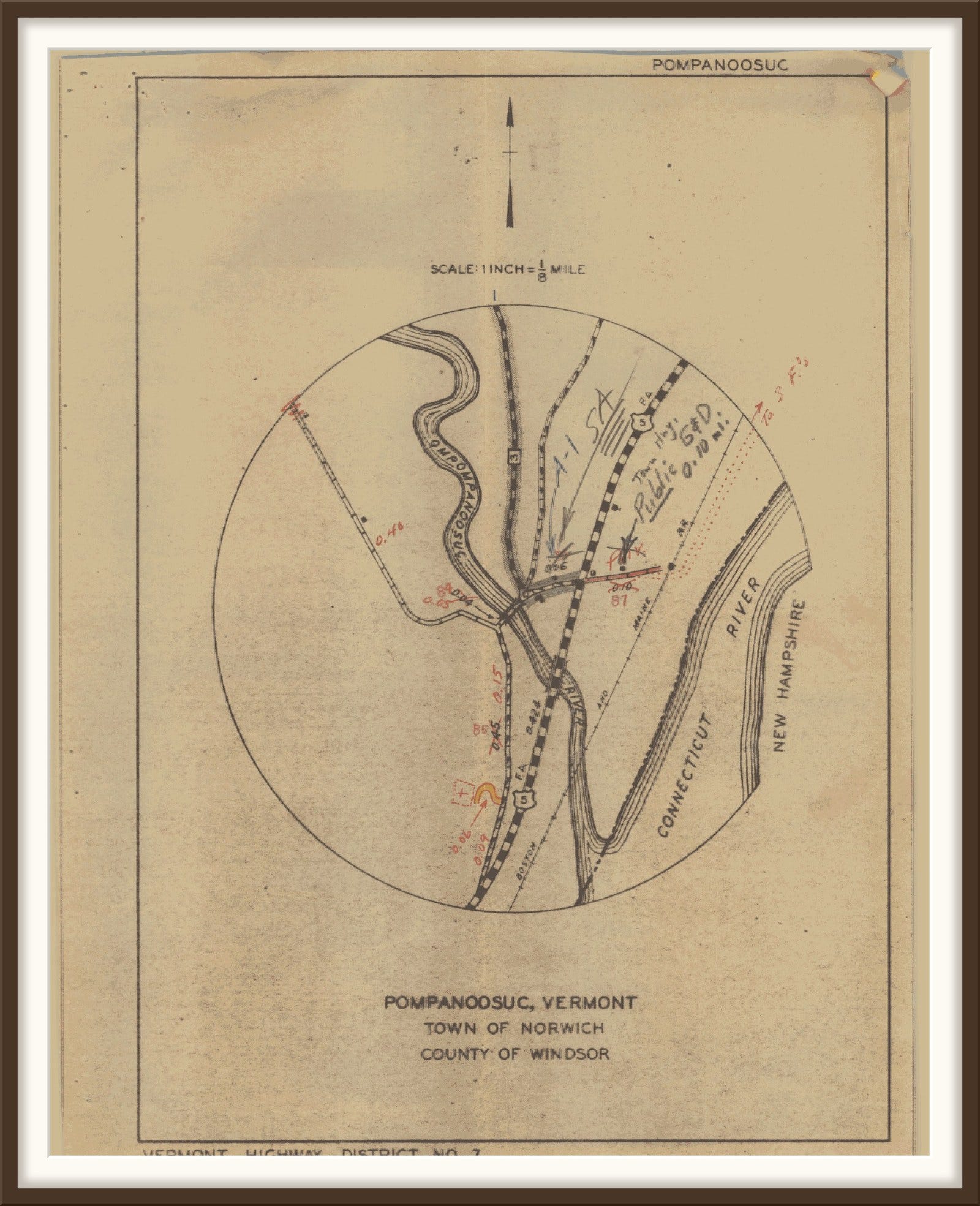
The box was not a state route like the 5. It was the town’s own number for a state aid road, one the state helped the town pay for. The same road is number 2 on Thetford’s map. After the Union Village Dam went in, someone at the highway department wrote “VT 132” on Thetford’s map in pencil.
Before Interstate 91, Waterman Hill Road ran down to the old bridge. You can follow it on Stevens’s map, from Waterman Hill to number 10.
Stevens also marked number 4, the Pompa Fair Grounds, with its half-mile race track. Larry Coffin has written about the fair the Pompanoosuc Agricultural Association held there from 1886 to 1894.
More from the river roads


A word of thanks
Peter Allen and the Evans Map Room at Dartmouth Library, for the Stevens map and its index. The Norwich Historical Society, for the postcard.
Full-resolution images
Thanks for your support, as always,
Cameron Cross
Sources
Norwich Historical Society: postcard of the Pompanoosuc covered bridge
M. E. Goddard and Henry V. Partridge, “A History of Norwich, Vermont,” 1905
Hartford Historical Society: Martha Knapp, “Abenaki Life,” newsletter, November 2011
Vermont Highway Department: Pompanoosuc inset, Town of Norwich highway map, 1945
Great River Hydro: “Grounded in History, Poised for the Future,” Wilder Station history
U.S. Geological Survey: Mt. Cube, N.H.-Vt., topographic quadrangle, 1:62,500, 1931
U.S. Geological Survey: The National Map, USGS Imagery (aerial photograph)
Larry Coffin, In Times Past: “Early Agricultural Fairs: Farmers’ Showcases,” September 2016

Great storytelling! 👌🏻