

Jigsaw for November 7, 2026: https://puzzles.curioustorian.com/woodstock-road-1855
We all know Quechee Gorge and the glorious, incongruous bridge that spans the Ottauquechee River far below.
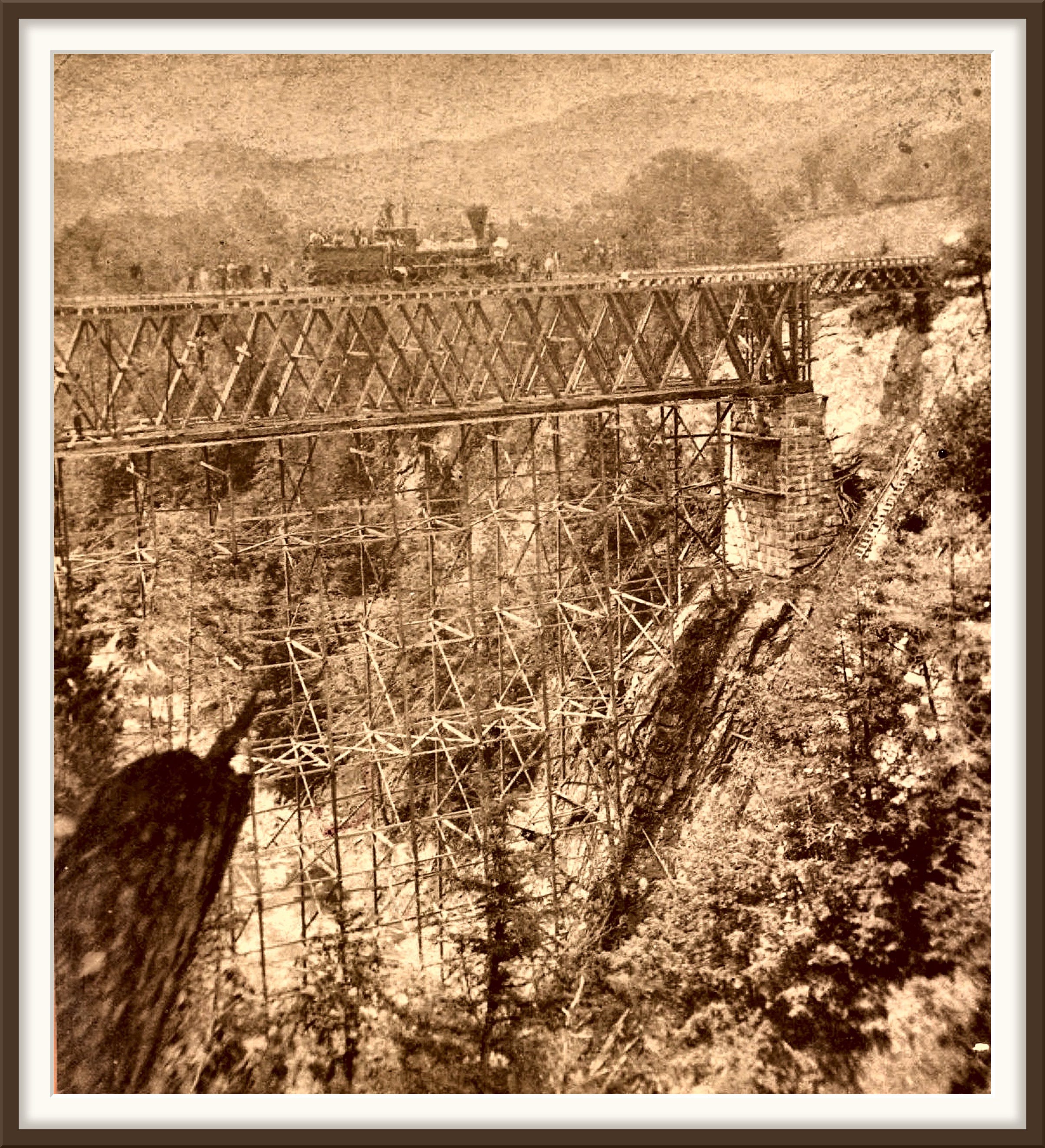
Then we become aware of the erstwhile Woodstock Railway, and gradually about its history and route, and come to know that the first bridge was built to carry the railroad its final few miles to the Junction in downtown White River. That first bridge was a wooden truss, a lattice of timbers that carried the trains 168 feet above the water.
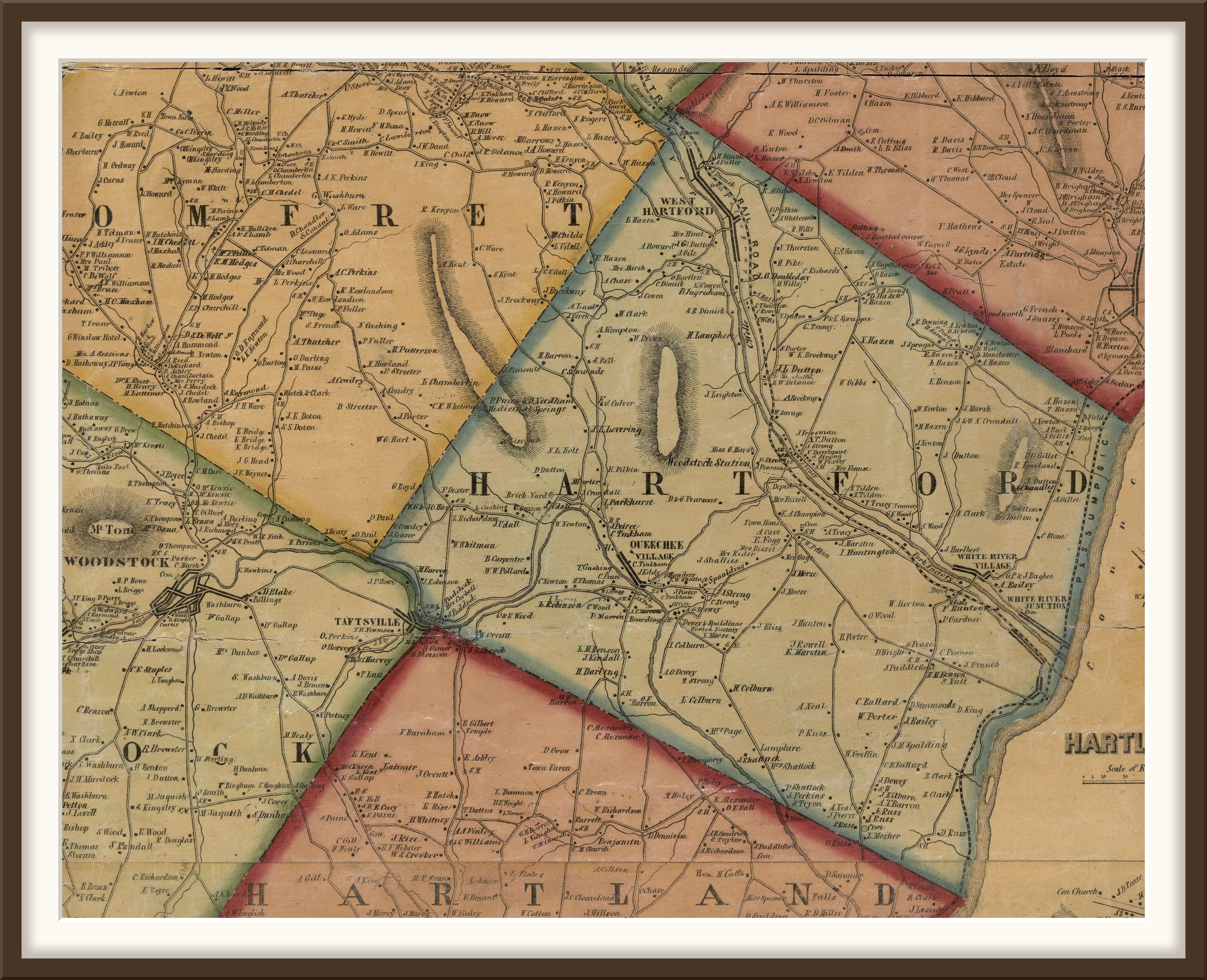
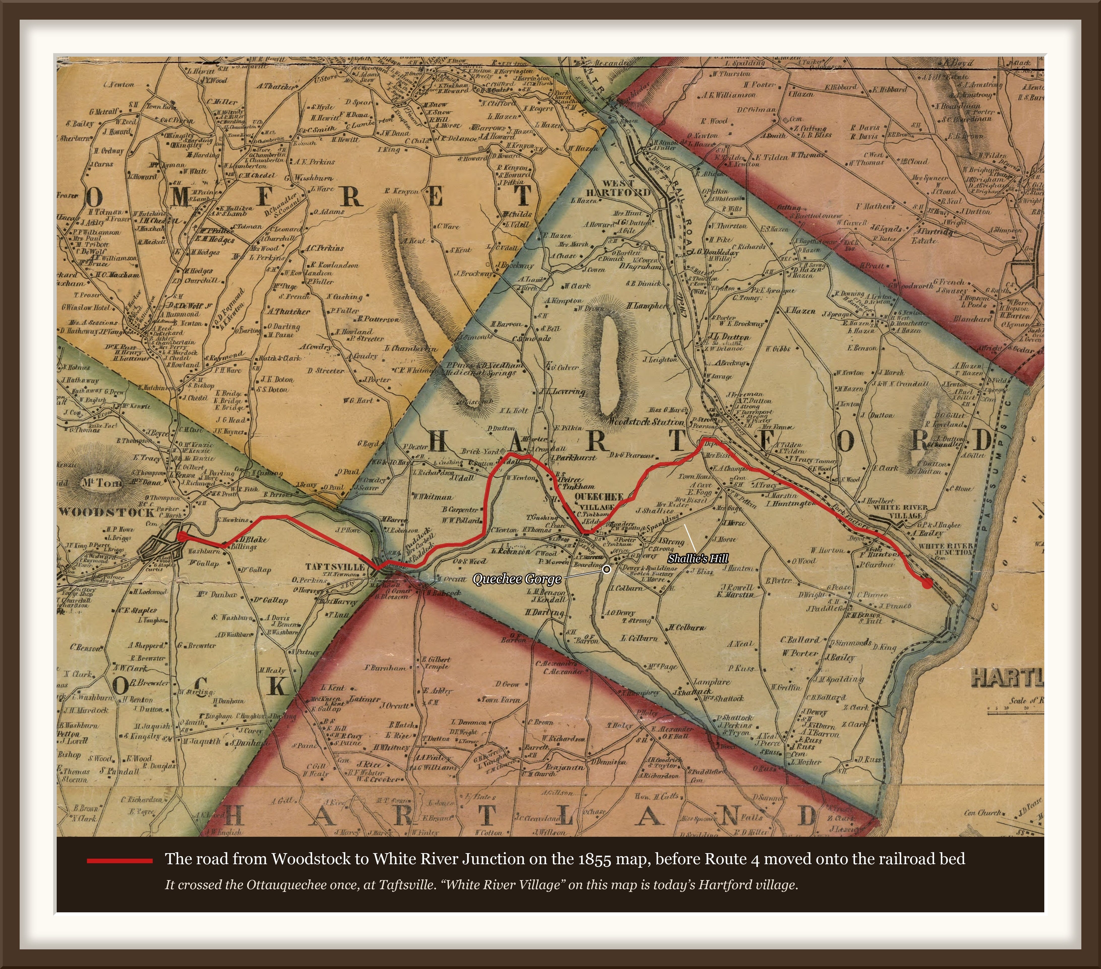
And then, gradually, we realize that before the bridge, the road from Woodstock took a much more circuitous route from Taftsville, one that can still be driven.
It is also still possible to see, and even stroll on, the old railroad bed, abandoned since the last run of the railroad in 1933.
As is often the case, one idle question led to a network of questions and discoveries that go beyond one Curioustorian post. So we'll start with the driving route, and note other avenues for future exploration and discovery.
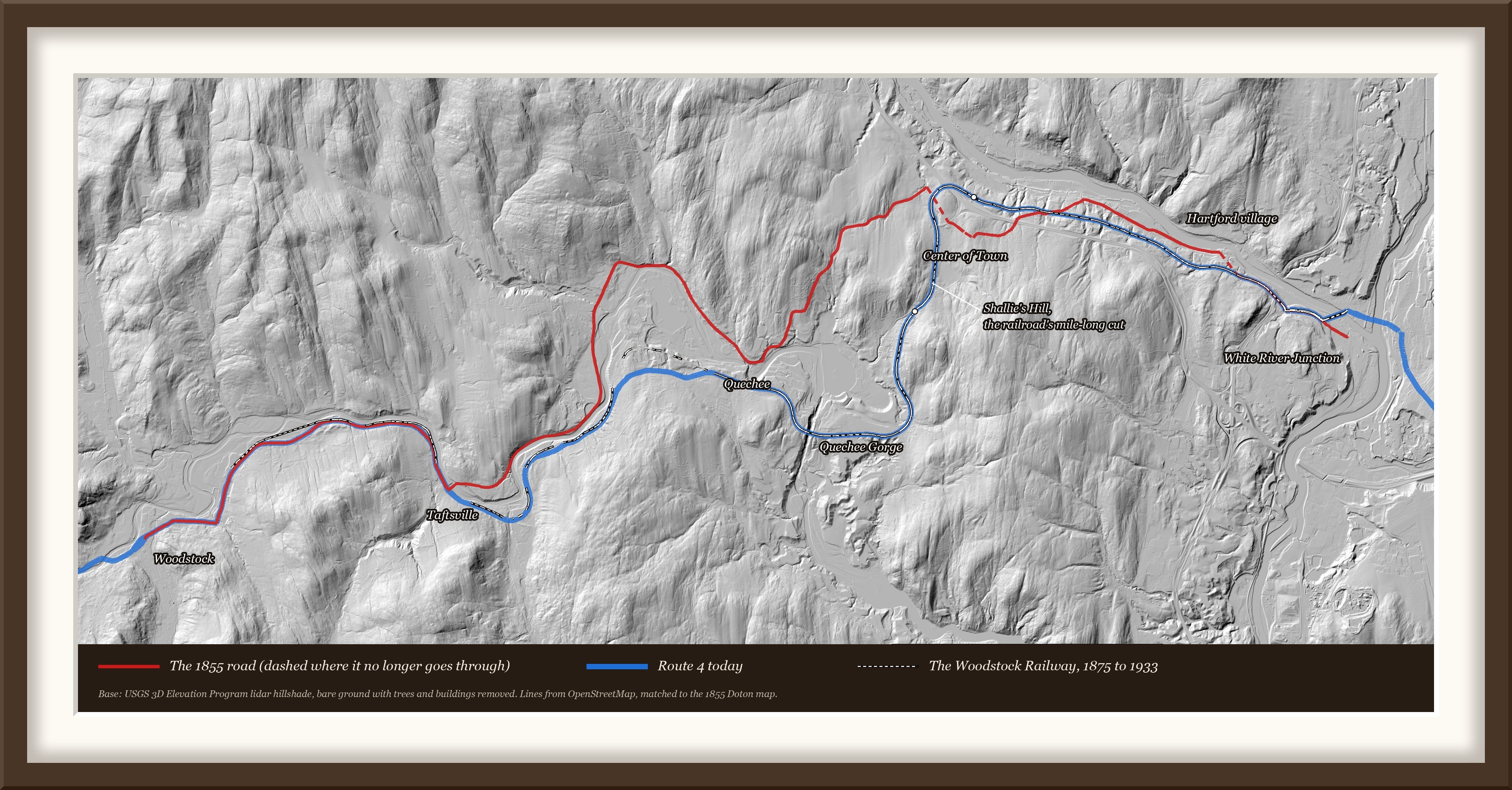
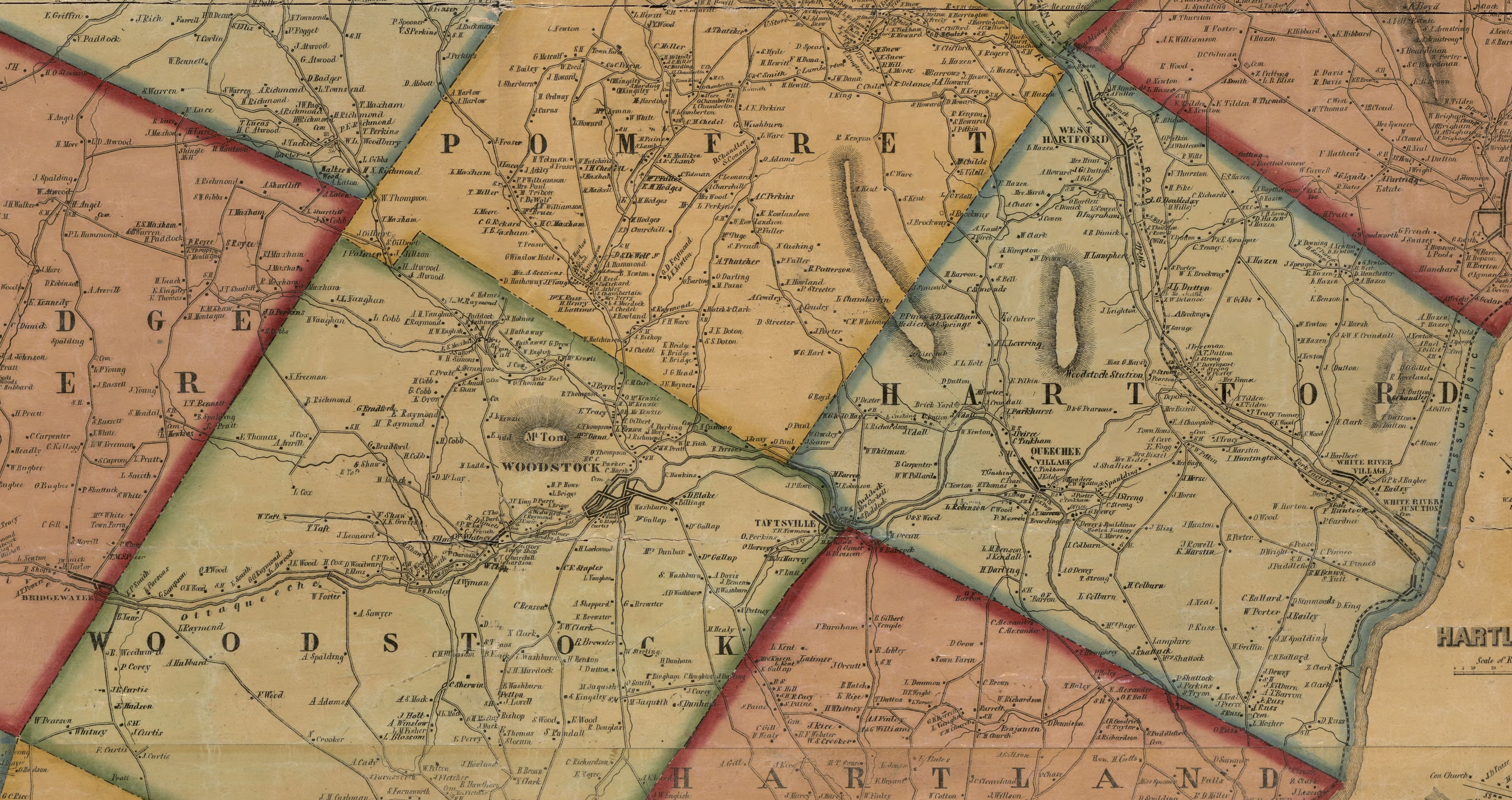
In 1855 the road crossed the Ottauquechee once, at Taftsville, kept to the north bank into Quechee village, climbed to the railroad depot in Hartford, passed through Hartford's old town center, and followed the White River down to the Junction. That is about sixteen miles. By stage, at five or six miles an hour, it was close to a three-hour trip.
In 1875 the Woodstock Railway opened. It took a straighter line, high above the river, and crossed Quechee Gorge on a wooden bridge. The trip took 37 to 45 minutes. The steel arch we know replaced the wooden bridge in 1911.
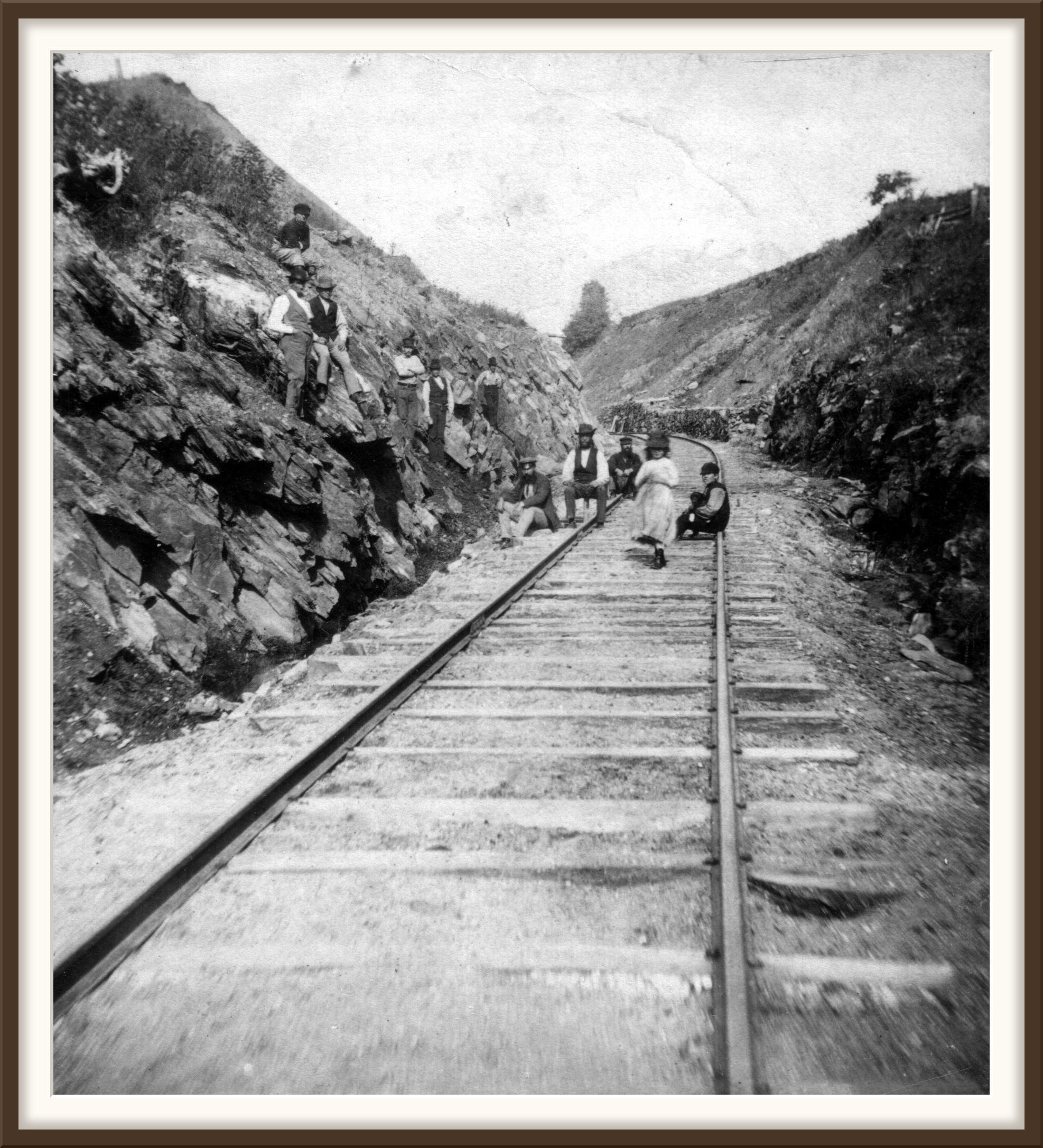
The last train ran on April 15, 1933. That June the state bought the railroad's right of way and laid the new Route 4 on it, from just west of Quechee village to White River Junction, across the Gorge on the railroad's bridge.
The roads that time forgot
The old road is still there. Quechee Main Street, Old Quechee Road, Center of Town Road and Old River Road follow it most of the way. Only a short piece near the depot was lost under I-89.
How to drive it today
From the Woodstock green, follow Central Street and Pleasant Street east onto Route 4. At Taftsville, turn left across the covered bridge.
On the far side, Quechee Main Street follows the north bank of the river about four miles into Quechee village. From the village, Old Quechee Road climbs north about two miles toward Route 4 and I-89, near where Woodstock Station stood.
The next piece of the old road is lost under the interstate. Costello Road, a short stretch of Route 4 and Stagecoach Road bring you around to Center of Town Road, Hartford's first town center.
From there Smith Road leads down to Old River Road, which follows the White River east. Mill Road takes you back to Route 4, and North Main Street brings you into White River Junction. About sixteen miles, and well under three hours.
For another day
The railroad bed. You can walk a piece of it in the park by the old Woodstock depot, where Route 4 turns sharply into the village. Driving west on Route 4, you can catch a glimpse of another piece just before Taftsville. Hartford's old Center of Town, where the meeting house stood until 1840. And a set of maps you can layer and compare yourself. More to come.
More from Quechee and White River Junction


A word of thanks
To the Hartford Historical Society, for its history of the Woodstock Railroad.
Full-resolution images
The 1855 map of Windsor County, full resolution
The Gulf Bridge over Quechee Gorge, full resolution

The cut at Shallies Hill, 1875, full resolution
Thanks for your support, as always,
Cameron Cross
Sources
Hosea Doton, Map of Windsor County, Vermont, 1855 (Library of Congress, via Wikimedia Commons)
Cut at Shallies Hill, Woodstock Railway, 1875 (UVM Landscape Change Program, LS04660)
Barrett, The Woodstock Railroad (Hartford Historical Society)
Vermont State Highway Department, NRH Project 108-C, Woodstock-White River Junction Road, approved June 15, 1933 (VTrans record plans).
William Howard Tucker, History of Hartford, Vermont (1889).
Maps: USGS topographic base map and 3DEP lidar elevation; road and rail lines from OpenStreetMap contributors.

The track bed is easy to spot running parallel to Route 4 on its north side. Although the line ended in Woodstock it was meant to continue and, if you look at the 1869 Beers Atlas of Windsor County, you’ll see that Bridgewater has a rail line through it…that was never actually built.