

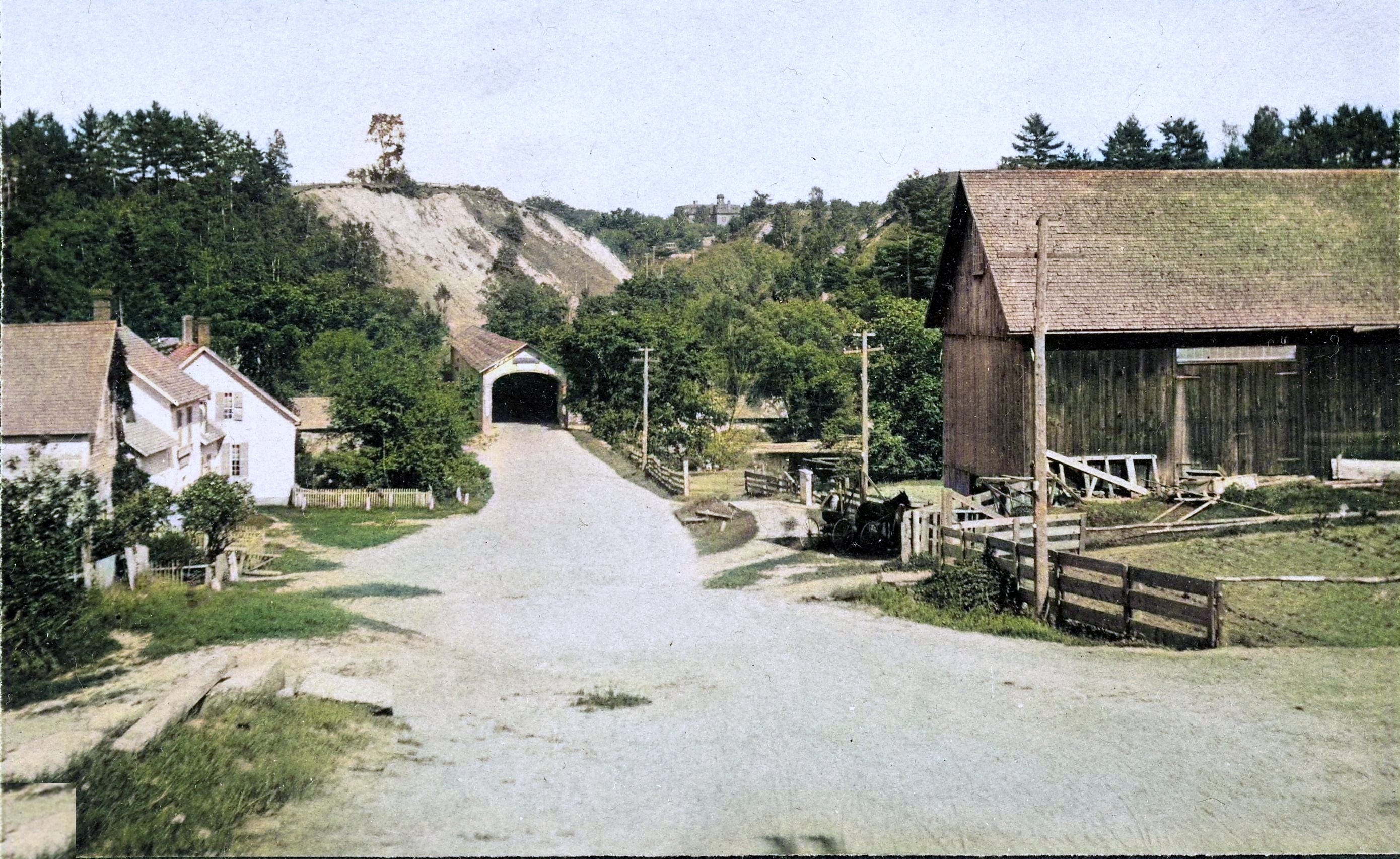
This week’s jigsaw: https://puzzles.curioustorian.com/lewiston
We are looking east from Lewiston, Vermont. That’s the last covered Ledyard bridg.
This post started out as a chance to see a beautiful summer scene that most people have never seen, and then to show you a related post. Once again, the rabbit hole opened.
The picture came from the Rauner library as a blue picture, a cyanotype. I asked for a black-and-white version, because I clearly wasn’t going to post that blue one as a puzzle. The black and white was fine, but then, why not make it more “realistic”? Why not a “true-to-life” rendition of what is now a black-and-white photo, and bring it back to life? See the image strip below.


I noticed the building in the middle horizon and realized that is the former Hanover High School (originally also housing the grammar school, both actually built on Allen Street.)

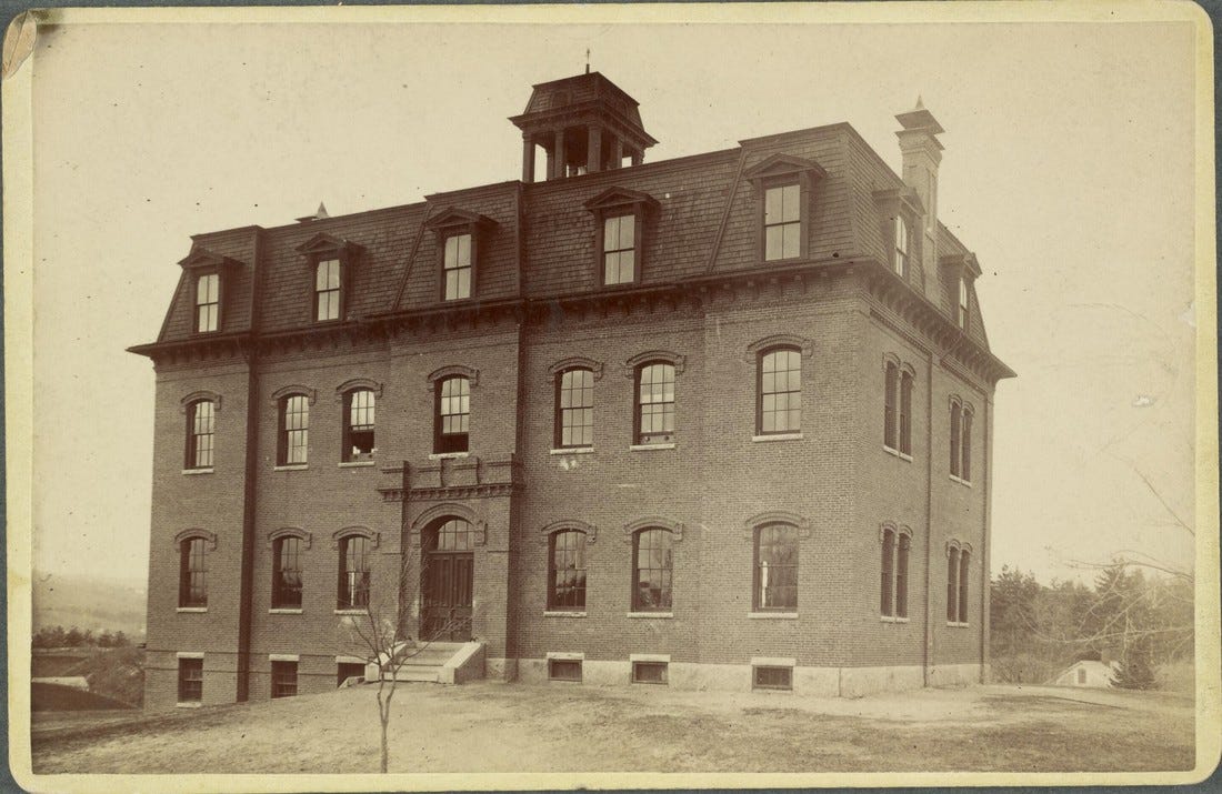
The school itself, up close. Photo by Howard Henry Harrison Langill, the Dartmouth Photographic Studio; Rauner. (Same Langill as our West Lebanon & White River Junction post.)
Here it is on the map, so you can see exactly where it stood:
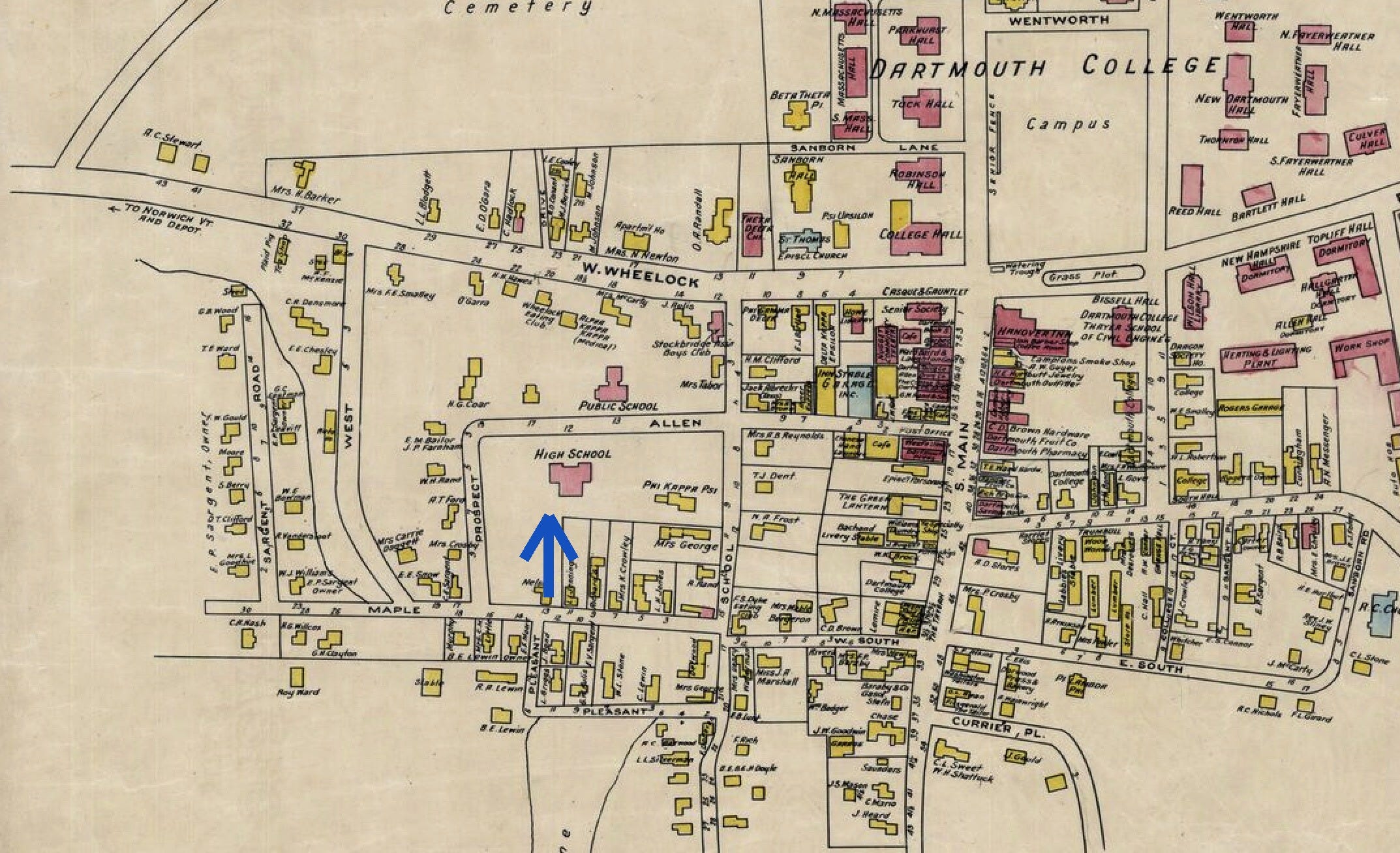
There it is (blue arrow), "High School," right on Allen Street, in the 1928 Hanover map. See the original post and the full map.
Now the other striking thing. Beyond the Ledyard Bridge, to the left of the road heading up into Hanover, there is a huge sandbank that looks freshly excavated. And I realized that sandbank was lake bottom. See the post below about the lake, whose level once rose as high as the clock on Baker Tower. Baker Tower, of course, did not exist ten thousand years ago.
👉 The Lake Hitchcock post
Here is the same view, more or less, that I stood and took yesterday from about where the old photographer stood. The story of Lewiston’s demise is a sad one. Time marches on.
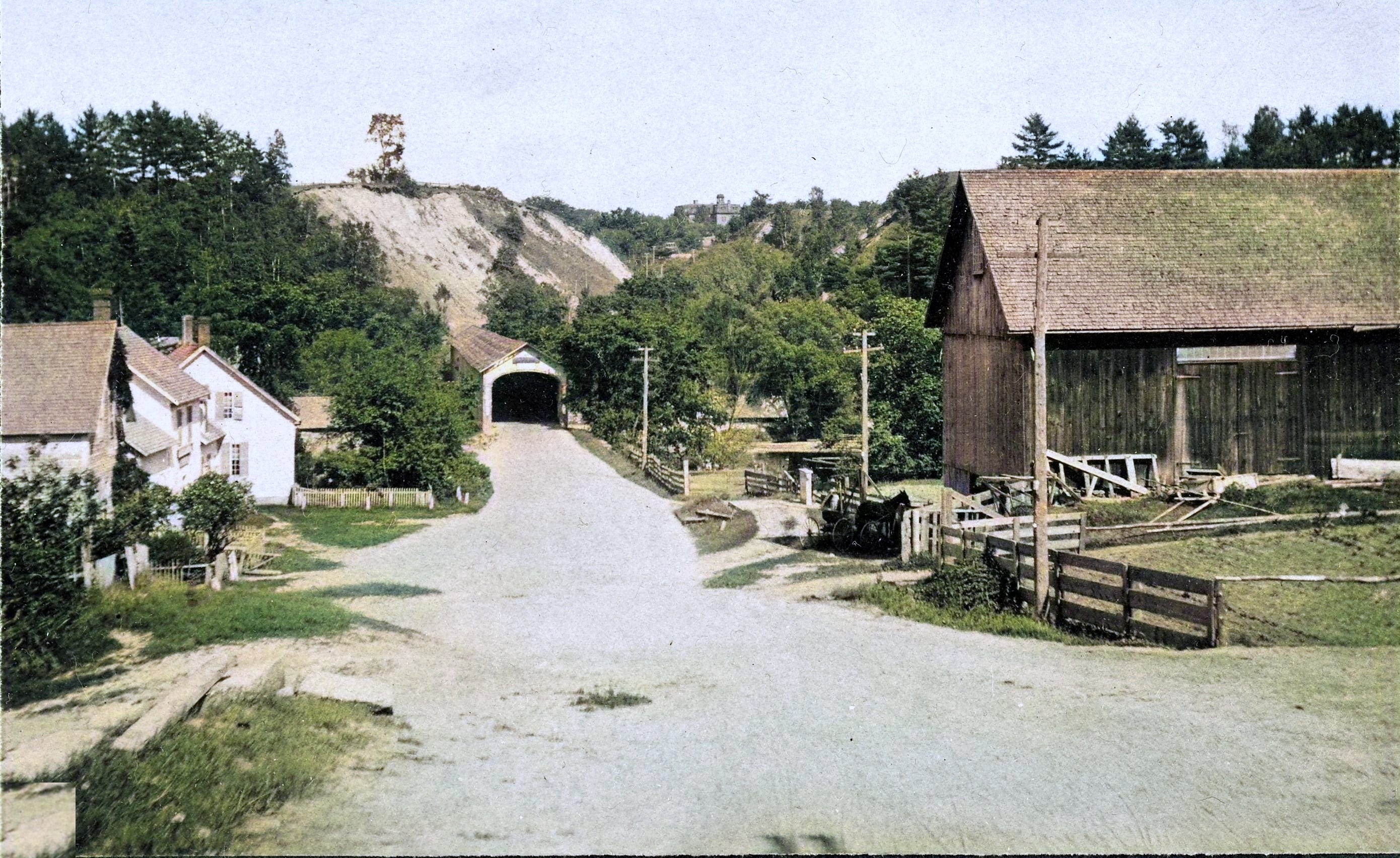
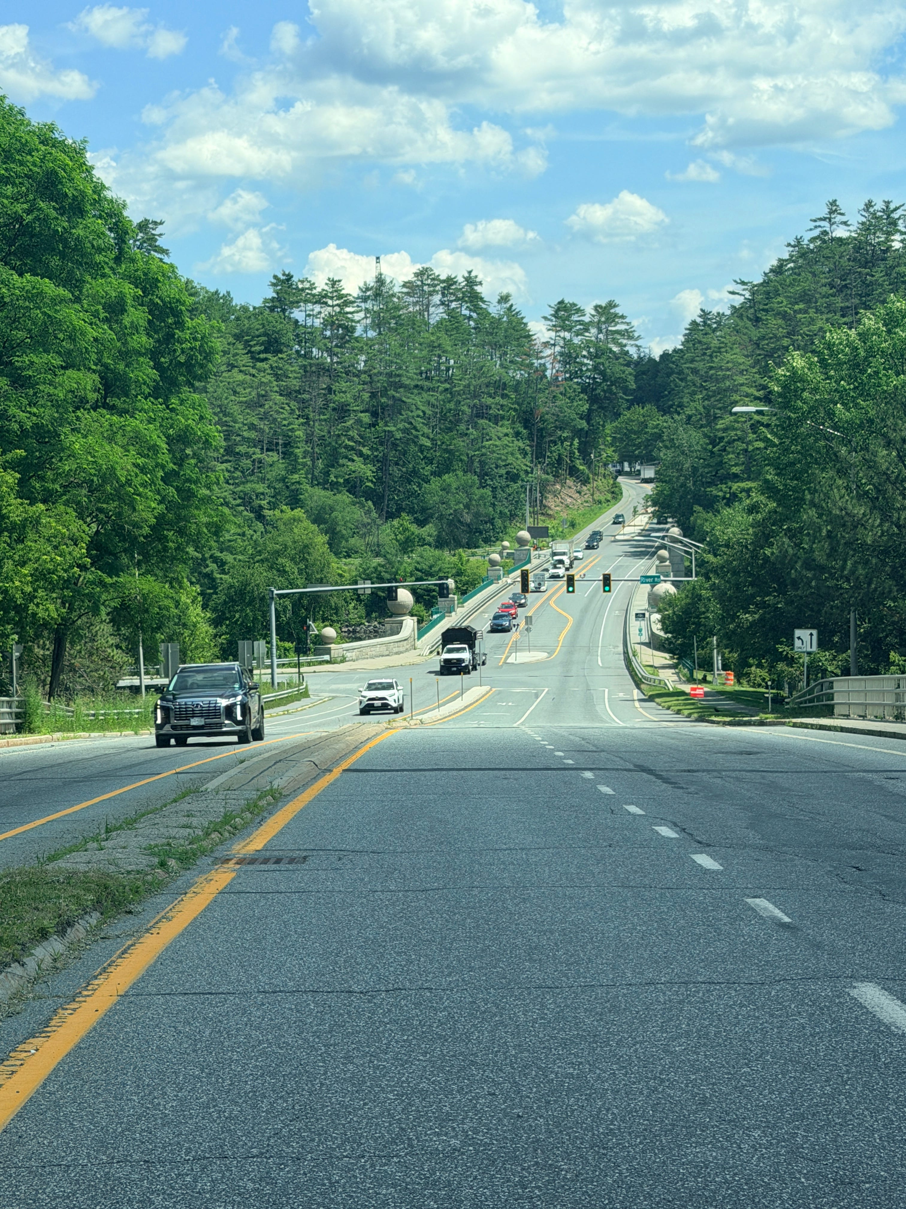
July 9, 2026
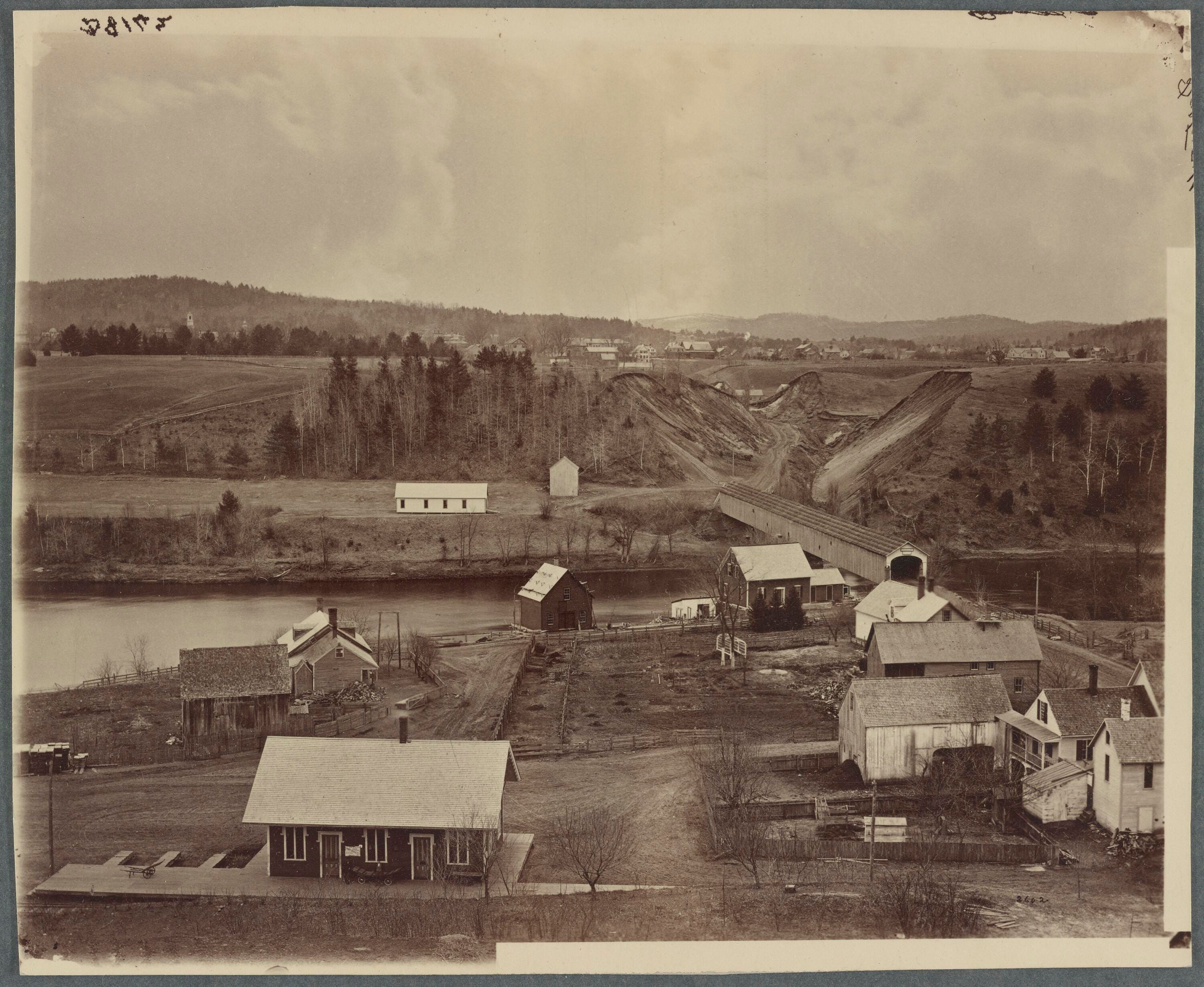
From an even earlier time. You can see Baker Tower in the left distance.
And West Wheelock is not finished changing yet. Here is what it will look like a few years from now: Dartmouth's rendering of the two new residence halls rising at 37-39 West Wheelock, due in 2028. Built of brick, as it happens, just like the old school on the hill.
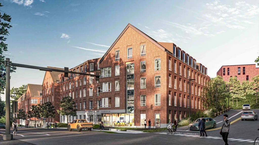
37-39 West Wheelock as it will look when finished. Rendering courtesy Northstar Project & Real Estate Services / Dartmouth; architect Elkus Manfredi. Project page.
Feel free to share this post if you are so inclined.
Thanks for reading, as always,
Cameron Cross
More related posts and puzzles
Ledyard Bridge, Now in Color — the same crossing, seen from the river.
Hanover Boat Association Outing, 1889 — a summer row on the river below.
1928 Map of Hanover — up the hill, where that road is heading.
SOURCES
Main photograph: “Ledyard Bridge Old 1,” 1899, Dartmouth College Photographic
Files, Rauner Special Collections Library, Dartmouth College; colorized by The Curioustorian.
School building photograph: Howard Henry Harrison Langill (the Dartmouth Photographic Studio, Hanover), Rauner Special Collections.
1928 map detail: from our own 1928 Map of Hanover. School history: History of Hanover, N.H. (1886).
Glacial Lake Hitchcock and the Baker’s-clock-face water level: “Hanover in the Ice Age,” Dartmouth Alumni Magazine, November 1957; see also our Lake Hitchcock post.
West Wheelock rendering: courtesy Northstar Project & Real Estate Services / Dartmouth (architect Elkus Manfredi), 37-39 West Wheelock project.